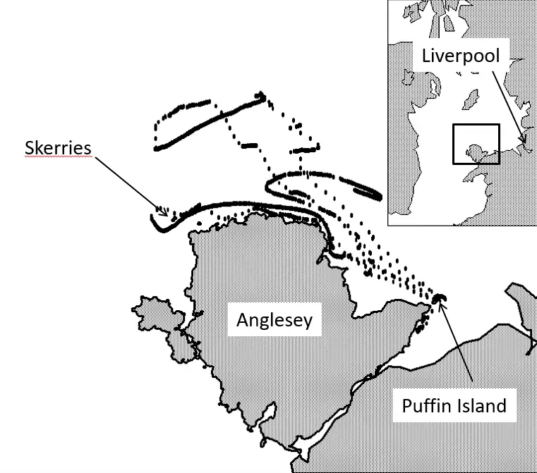
Track of one of the tagged birds
This diagram shows the study site and the track of one of the tagged birds from 17 to 21 May 2012. When the bird is flying from its base on Puffin Island, the points are relatively widely spaced. When it is sitting on the water, they are closely spaced and the movement is consistent with that of the travelling tide. The inset map shows the position of the study area within the Irish Sea and relative to Liverpool, which lies 70km east of Puffin Island. (Image and caption adapted from the Ocean Science study)
Credit: Cooper et al., Ocean Science, 2018
Related EGU articles
- What seabirds can tell us about the tide (29 November 2018)
Download
- Original image (160.0 KB, 761.0x671.0 px)

