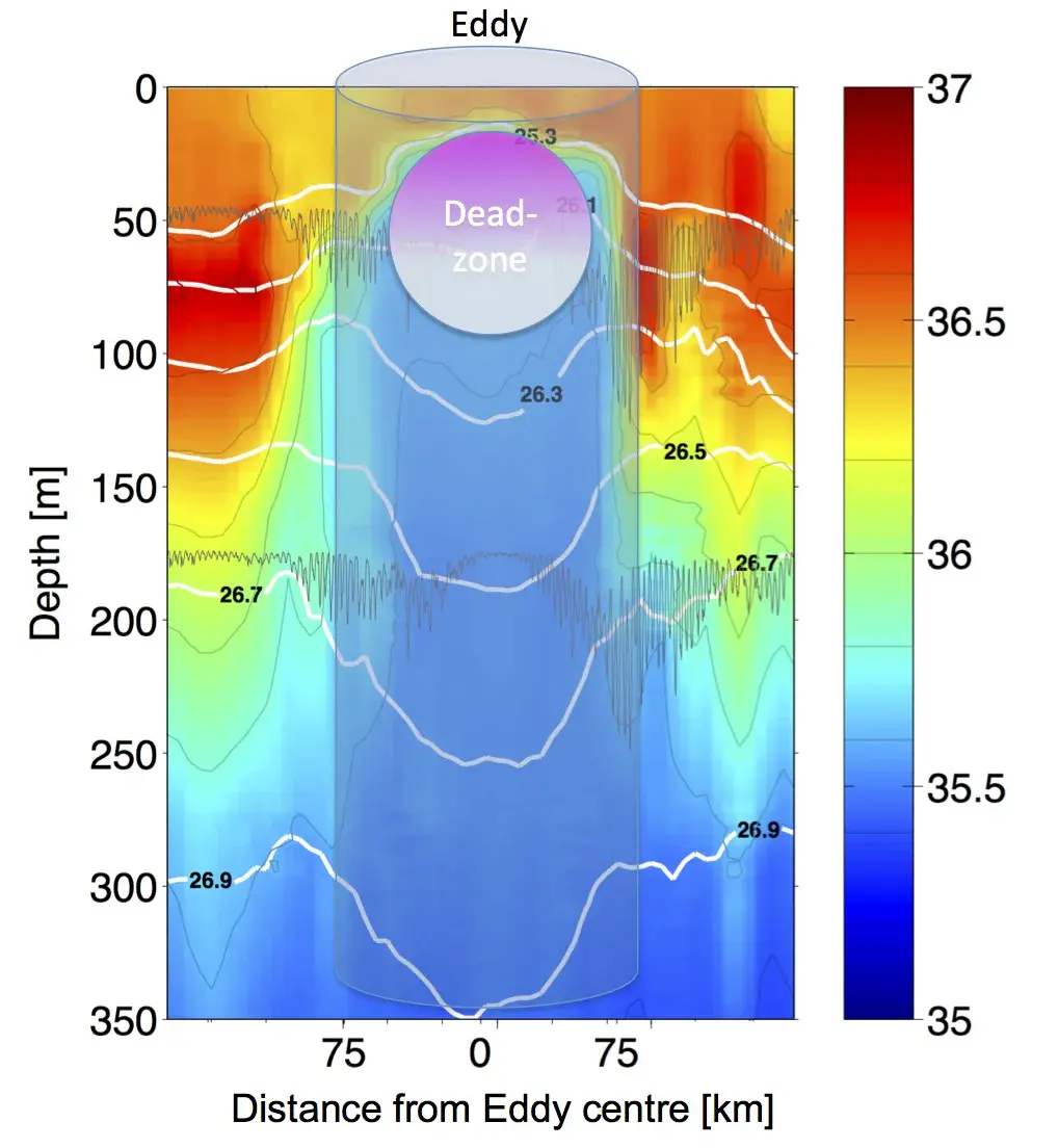
Eddy salinity, dimensions and dead-zone schematic
This plot shows a salinity section of the upper 350 metres of sea water observed across an eddy passing through the Cape Verde Ocean Observatory mooring. As the water in the eddy originates from the African Coast it is much lower in salinity than the surrounding water.
The white contours represent levels of constant sea-water density, which bend downward towards the centre of the eddy, indicating rotation.
The dead-zone (represented by the magenta circle) develops in the centre of the eddy at a depth range of about 20 to 100 metres, below a shallow surface layer that is under the direct impact of atmospheric forcing (wind, warming and cooling). This eddy has a diameter of about 120 to 140 km.
Credit: J. Karstensen/GEOMAR/Biogeosciences
Related EGU articles
- ‘Dead zones’ found in Atlantic open waters (30 April 2015)
Download
- Original image (179.3 KB, 1018.0x1104.0 px)

