
Media highlights
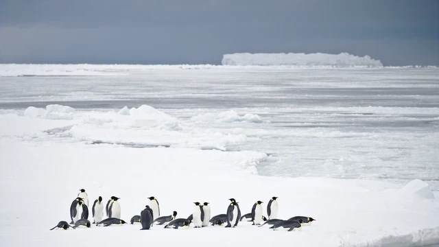
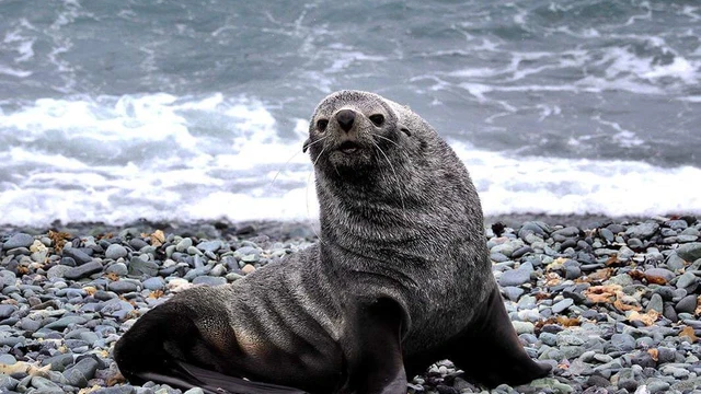
Emperor penguins are adapting to changing ice conditions, but until when?
Emperor penguins depend on stable fast ice to breed, yet climate change threatens their icy habitats. New research tracking the Astrid, Mertz, and Sanae colonies over four decades (1984–2024) reveals how these iconic Antarctic birds respond to shifting ice conditions. By analyzing satellite imagery from Landsat, ASTER, and Sentinel-2, researchers mapped colony movements, calving events, and early fast ice break-outs, key factors influencing penguin survival.
Findings show that colonies tend to return to the same sheltered sites annually, yet major ice calving events at Mertz and Sanae have forced them to relocate—sometimes to less stable areas where early fast ice break-outs threaten breeding success. In a surprising twist, the study also found emperor penguins moving onto ice shelves and even icebergs, even when fast ice remained available.
Understanding these adaptation patterns is critical as Antarctic sea ice reaches record-low levels, with projections warning that over 90% of emperor penguin colonies could face near-extinction by 2100. This research provides crucial insights into their resilience and helps scientists model future responses to a rapidly changing environment.
You can find the abstract here.
Don’t miss the full presentation: Thursday, 01 May, 16:45–16:55 CEST in Room L3.[Session CR1.7]
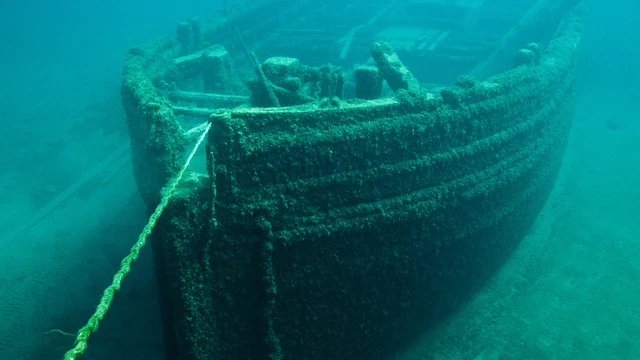
AI’s underwater treasure hunt: On shipwrecks and their environmental secrets
Beneath the ocean’s surface, millions of undiscovered shipwrecks hold secrets of the past—but also hidden dangers for marine ecosystems. Beyond their historical intrigue, these wrecks can leak toxic substances, creating “Black Reefs”—areas of coral degradation linked to metal corrosion and fuel spills.
Researchers from the University of Southampton and the University of Oxford are using AI-powered remote sensing to locate shipwreck sites by detecting their environmental footprints. By training convolutional neural networks (CNNs) on high-resolution imagery, their model can identify reef discoloration and map shipwreck locations, even when the vessels themselves have disintegrated.
Despite challenges like limited training datasets, their SimpleNet architecture successfully pinpointed shipwreck-linked reef damage in key locations, offering a groundbreaking method for maritime archaeology and ecological monitoring. With UNESCO estimating over 3 million wrecks remain undiscovered, AI-driven approaches could revolutionize our understanding of human impact on marine environments.
You can find the abstract here.
Don’t miss the full presentation: Thursday, 01 May, 16:15–18:00 CEST in Hall X4 (X4.74) L3. [Session ITS1.2/OS4.8]
Could DNA buried in sand hold the key to understanding coastal disasters?
Scientists at Nanyang Technological University and Adam Mickiewicz University are using sedimentary ancient DNA (sedDNA) to identify storm and tsunami deposits—even those dating back thousands of years.
By analyzing microbial fingerprints in tsunami-affected sediments from the 2004 Indian Ocean Tsunami and the 2018 Palu tsunami, researchers are uncovering new ways to distinguish tsunami deposits from ordinary storm layers. This breakthrough could transform how we predict and prepare for future coastal catastrophes by providing a clearer record of past events.
Despite challenges in preservation and interpretation, sedDNA is proving to be a game-changing tool for geologists and disaster researchers. When combining it with traditional sediment analysis, scientists can piece together a more detailed history of extreme coastal events, helping communities better prepare for the next big wave.
You can find the abstract here.
Check out the full poster: Tuesday, 29 April, 08:30–10:15 CEST (Display time: 08:30–12:30) in Hall X3, X3.115. [Session GM8.4]

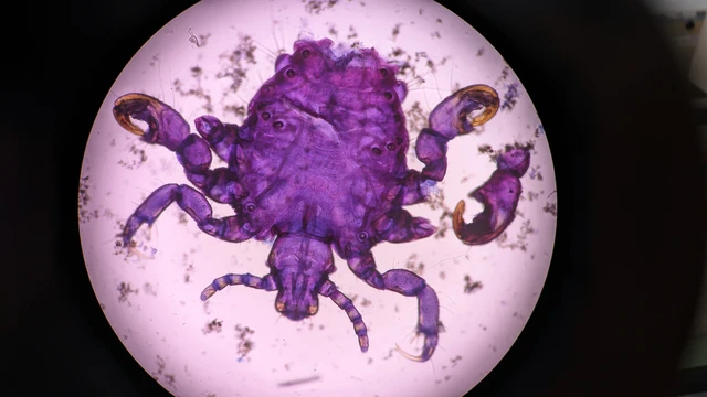
A worm’s eye view: The evolution of parasite diversity across time
New research is shedding light on the hidden world of parasites across the Holocene. A team of scientists has compiled data from over 700 archaeological and paleoparasitological studies to create a comprehensive database of parasite occurrences, spanning thousands of years. Parasites, often overlooked in fossil records, play a vital role in ecosystems today and are crucial to understanding past environmental and human health dynamics.
Using 3,000+ parasite occurrences from ancient human settlements and burials, the study offers ground-breaking insights into how parasite diversity shifted with human population growth and seasonal changes. By analysing this rich data, researchers are now able to map parasite distribution with unprecedented spatial and temporal precision, influencing both ecological modelling and macro-evolutionary analyses.
The study reveals how parasites like nematodes and flatworms became more prevalent during the Middle Ages, which reflects major shifts in human behaviour and environmental conditions. This work highlights the significance of parasitic organisms in understanding historical health and ecological shifts.
You can find the abstract here.
Don’t miss the full presentation: Tuesday, April 29, 14:40–14:50 (CEST) Room -2.93 [Session SSP4.2]
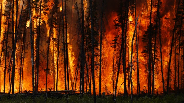
Could wildfires have sparked extinction? A connection to the end-triassic catastrophe
Continental-scale wildfires played a key role during the end-Triassic greenhouse warming, a period marked by catastrophic climate change and the extinction of countless species. New research using palynological data from multiple locations reveals how extreme wildfires contributed to the collapse of terrestrial ecosystems at this critical time in Earth’s history. The study, which focuses on palynomorph darkening in fern spores and pollen, identifies signs of frequent surface fires in what would have been widespread fern savannahs.
The data from cores in Germany, Denmark, the UK, and Luxemburg highlight a significant darkening of pollen and spores that is inconsistent with simple thermal effects during burial, suggesting that wildfires were a driving force behind this phenomenon. These fires, along with increased soil erosion and mass removal of charred organic material, point to the devastating consequences of wildfires on terrestrial vegetation during the end-Triassic. This research offers new insights into how heat stress from wildfires may have triggered the collapse of ecosystems, contributing to the broader end-Triassic extinction event.
You can access the full abstract here.
Don't miss the oral Presentation: Thursday, May 1, 09:55–10:05 (CEST) Room: G1 [Session SSP1.2]
Space junk and inaccurate tracking: Why shallow entries are making geolocation a mess!
Infrasound analysis is critical for bolide detection and accurate geolocation, but uncertainties arise due to mismatches between observed and predicted azimuth angles, especially during shallow entry conditions. New research by Elizabeth Silber from Sandia National Laboratories investigates the role of entry geometry in improving the precision of bolide detection over distances up to 15,000 km. The study reveals that shallow-angle entries often result in large discrepancies in azimuth measurements, complicating geolocation, while steeper trajectories lead to more reliable azimuth data.
By incorporating entry geometry into infrasound analysis, this study aims to refine bolide detection methods, contributing to planetary defence. The framework could also have implications for spacecraft re-entries and other high-energy atmospheric phenomena, where accurate geolocation is essential for safety and monitoring.
You can find the full abstract here.
Don't miss the full presentation: PICO Presentation: PICO | Friday, 02 May, 11:28–11:30 (CEST) PICO spot 5 [Session SM8.5]

Is my shampoo in Antarctica? The surprising global journey of personal care chemicals
Antarctica’s snow reveals more than just cold: it’s carrying a trace of everyday life!
Giulia Genuzio’s study explores the seasonal variability of Personal Care Products (PCPs), including fragrances and UV-filters, in Antarctic snow. Her findings highlight how long-range atmospheric transport brings these compounds, commonly found in cosmetics and detergents, to remote regions, with concentrations peaking in late summer. This work reveals how human activities from research stations and tourism contribute to environmental contamination, despite Antarctica’s isolated location. The research also uncovers how salicylates are the dominant compounds found, likely influenced by synoptic air-mass circulation.
You can find the full abstract here.
Don't miss the oral session: Thursday, May 1, 14:55–15:05 (CEST) | Room L3 [Session CR1.7]
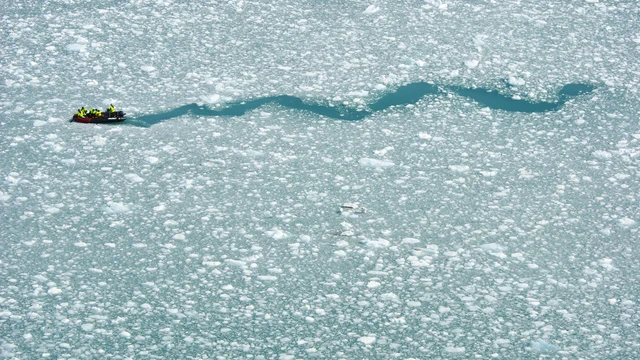
Ice, Ice, Data: On crowdsourcing citizen science in polar expedition cruises
Citizen Science (CS) is emerging as a powerful tool for advancing polar research while fostering public engagement in environmental science. With limited accessibility and shrinking resources for traditional research in the Arctic and Antarctic, partnerships between scientists and the expedition cruise industry offer a cost-effective way to expand data collection across vast, under-researched regions.
HX | Hurtigruten Expeditions has integrated CS into its Science & Education Program, enabling guests to actively participate in scientific research. In 2024 alone, HX welcomed 80+ researchers aboard, spanning 1,900 cruise nights, and facilitated over 30,000 data contributions to more than 20 global CS projects. But how does this experience impact participants? A 2022–2023 study with the University of Tasmania found that many guests left with a deeper understanding of polar ecosystems and a greater sense of urgency about climate change.
Despite this success, HX represents only 8% of the Antarctic expedition cruise market—meaning the potential for broader industry-wide collaboration remains largely untapped. Expanding CS efforts across the sector could revolutionize polar research, making tourism-driven science a key player in environmental monitoring and conservation.
You can find the abstract here.
Don’t miss the full presentation: Thursday, 01 May, 14:15–14:25 CEST | Room -2.93 [Session EOS1.1]
A pain in the creek! A toxic tale for freshwater plants
A study led by Hanna Kornacka and colleagues from Wrocław University of Science and Technology reveals how the widespread presence of ibuprofen in surface waters poses a serious environmental threat to aquatic ecosystems. As one of the most commonly used non-steroidal anti-inflammatory drugs (NSAIDs) globally, ibuprofen enters water bodies largely due to ineffective wastewater treatment processes, accumulating in the environment and impacting local flora and fauna.
Focusing on Lemna minor, a small freshwater plant species that serves as a model organism in ecotoxicology, the study investigates the plant's reaction to varying concentrations of ibuprofen. The research highlights the toxic effects of ibuprofen, which include leaf necrosis, chlorosis, and significant biomass reduction. These observations suggest that ibuprofen interferes with key physiological processes in the plants, disrupting their growth capacity and overall health.
By evaluating the relationship between ibuprofen concentration and its detrimental effects on biomass, chlorophyll content, and leaf area, the study provides new insights into how pharmaceutical pollution could be silently affecting ecosystems in aquatic environments. The findings raise concerns over the long-term effects of pharmaceuticals in surface waters, which can lead to the degradation of biodiversity and the disruption of ecosystem services provided by freshwater plants.
This study pushes the urgent need for more efficient wastewater treatment solutions and greater regulation to the forefront, if we want to prevent pharmaceuticals like ibuprofen from contaminating natural water sources. With freshwater plants acting as critical components of aquatic food webs, this research calls attention to the broader ecological consequences that could follow the unchecked presence of pharmaceutical pollutants.
You can find the full abstract here.
Don't miss the poster session: Thursday, May 1, 08:30–10:15 (CEST) | Hall A, A.149 [Session ITS3.15/HS12.3]

WWII sands tell tales: Using war-era sediments to study geomorphic processes
This year marks the 80th anniversary of the Allied Invasion of Normandy, and new sedimentological research is shedding light on the geomorphic processes that have shaped the region’s coastline since World War II. By using anthropogenic metals as tracers, scientists have mapped sediment accumulation rates and shoreline changes in a detailed study across five main D-Day beaches. These metals, linked to wartime activity, are helping researchers build a clearer picture of coastal dynamics over the past 80 years.
The study, which analyzed 300 samples from 16 surface transects and 21 sediment cores, reveals significant changes in grain size and metal concentration at key shoreline transitions. The team found that the foreshore (below the high tide line) is marked by finer sediments and higher metal concentrations, reflecting sediment transport processes and ocean energy. At greater depths, however, sediment accumulation rates are influenced by more complex historical factors, with metals likely tied to both the D-Day invasion and earlier industrial activities.
This unique approach provides new insights into sediment accumulation rates, with an estimated rate of 0.57 cm/year from the D-Day era, and sets the stage for future work to constrain sedimentary processes across coastal regions both historically and in modern times.
You can find the full abstract here.
Don't miss the full presentation: Wednesday, April 30, 17:00–17:10 (CEST) Room: -2.93 [Session GM8.7]
Rerouting the future: can smarter flight paths reduce aviation’s climate impact?
Aviation’s climate footprint isn’t just about CO2 emissions—contrail cirrus also plays a massive role, trapping heat and adding to global warming in complex, uncertain ways. Unlike CO2, which lingers for centuries, contrails are short-lived but can have strong, immediate climate effects.
This study, led by researchers from Chalmers University of Technology, University of Gothenburg, and Imperial College London, analyzed nearly 500,000 flights over the North Atlantic to determine if rerouting aircraft to avoid contrail formation could significantly cut aviation’s climate impact. Their results reveal that with a 1% fuel penalty, rerouting is beneficial for up to 35% of flights. However, the proportion drops if we demand higher confidence that rerouting actually reduces warming.
The key question: Can we improve contrail prediction enough to make rerouting a reliable climate solution? This research highlights the trade-offs between fuel burn, emissions reductions, and the uncertainties of contrail formation—critical factors for shaping the future of sustainable aviation.
You can find the abstract here:
Don’t miss the full presentation: Friday, 02 May, 08:30–10:15 CEST (Display time: 08:30–12:30) in Hall X5, X5.118. [Session AS3.19]
The" shock" files: An evolving archive of disasters that could have been prevented!
From megafires to pandemics, the world is experiencing more frequent and intense shocks than ever before. But what if we could track these crises in real time—learning from past disasters to prevent future ones?
Enter Shock Tracker, a living database of global crises, built by researchers at Stockholm Resilience Centre and the Royal Swedish Academy of Sciences. This ever-growing repository of over 100 cases catalogues wildfires, floods, disease outbreaks, and conflicts, mapping their causes, impacts, and human responses. By analysing how environmental and social factors collide, the Shock Tracker reveals that many so-called ‘natural’ disasters are actually shaped—or worsened—by human choices.
By identifying patterns across crises, the database offers a tool for researchers, policymakers, and communities to better anticipate and mitigate future shocks. In an era of cascading disasters, the Shock Tracker is turning hindsight into foresight—before the next catastrophe strikes.
You can find the abstract here.
Don’t miss the full presentation: Thursday, 01 May, 08:55–09:05 CEST in Room 2.17. [Session ITS4.6/CL0.11]

It’s going viral: Forecasting Europe’s flood-fuelled disease outbreaks
Waterborne diseases like leptospirosis abound after floods like the 2021 floods in Germany that killed 190 people. A new platform aims to forecast infectious disease risks from flooding and rising temperatures across Europe.
EpiOutlook is a tool that looks at specific epidemiological indicators to monitor the impacts of climate change on the emergence and spread of infectious diseases in Europe. The platform already works on drought, but now researchers are adding heat and flood risk to the platform. As both are increasing risks across the continent, the researchers hope EpiOutlook will help public health decisionmakers prepare for the risks posed by the changing climate.
Learn more about how EpiOutlook works and how it can be used to forecast potential infectious disease outbreaks to make Europe more resilient in a PICO presentation (hybrid Zoom meeting featuring onsite and virtual presentations) by Georgina Eva Ceres Charnley of the Barcelona Super Computing Center and colleagues on Monday 28 April at 11:05 CEST. This session includes additional presentations on everything from particulate matter effects on mental health to the impacts of warming temperatures on women in the Global South to an assessment of health risks due to climate change in Germany.
You can find the full abstract here.
Don't miss the poster session: PICO | Monday, 28 Apr, 11:05–11:07 (CEST) PICO spot 2, PICO2.7 [Session ITS2.4/CL0.5]
