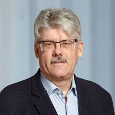
Markus Rothacher

The 2018 Vening Meinesz Medal is awarded to Markus Rothacher for his pioneering work in linking geometry, rotation and gravity to space geodetic observations and subsequently enhancing the understanding of the Earth system.
As an astronomer in geodesy, Markus Rothacher has always had the overview and foresight necessary to see the connection between observing both space geodetic techniques and Earth sciences. This comprehensive approach was already present during the early stages of his career. During his work at the Astronomical Institute of the University of Bern, Rothacher not only conducted outstanding work on the orbit determination of GPS satellites, but also used GPS to determine Earth rotation parameters with sub-daily resolution along with nutation while also focusing on high accuracy applications of GPS for geodynamic studies.
Rothacher’s comprehensive approach can also be tracked during his work on space geodetic techniques and to Earth sciences in general at the Technical University of Munich, GFZ Potsdam and ETH Zurich. In the context of gravity field modelling, Rothacher developed the technique of GPS-based kinematic orbit determination of low-Earth orbiters (LEO), the purely geometric estimation of high precision orbit ephemerides. This approach not only became an essential step in the use of GPS-based orbits for gravity modelling with CHAMP (the Challenging Minisatellite Payload), GRACE (the Gravity Recovery and Climate Experiment), and GOCE (the Gravity field and steady-state Ocean Circulation Explorer), but it also became the standard technique for Global Navigation-Satellite-System-based high precision orbit determination of LEOs.
Up to now, Rothacher has been working at the forefront of combining the three pillars of geodesy, namely, the Earth’s geometry, rotation and gravity field. However, Rothacher’s work does not end with the determination of geodetic parameters, he also considers the implication of his observations on the Earth system, e.g. how they could influence early warning systems for tsunamis. One can certainly state that Rothacher is one of the architects of the Global Geodetic Observing System (GGOS), which provides the geodetic infrastructure necessary for monitoring the Earth system and global change research and is the flagship of the International Association of Geodesy (IAG).
Rothacher’s more recent work is dedicated to the development of new satellites for geodesy and Earth sciences, e.g., the CubETH satellite and the E-GRASP/Eratosthenes mission. These missions allow Rothacher to use his broad knowledge in a wide range of disciplines.
Most of Rothacher’s ideas were developed together with students or in cooperation with international teams. He has a wide variety of interests, ranging from theoretical foundations, via numerical implementation, to technical developments and Earth applications. In addition, he does not hesitate to engage himself in the coordination and management of important national and international scientific programmes. The combination of Rothacher’s scientific achievements, team work and community contributions all explain the impact and the high relevance of his work in modern geodesy.
