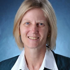
Kristine M. Larson

The 2015 Christiaan Huygens Medal is awarded to Kristine M. Larson for her exceptionally innovative work to improve algorithms for high precision GPS data analysis.
Kristine M. Larson has developed exceptionally innovative work with GPS instrumentation in the past decade. GPS is best known in geophysics for its application in measuring small deformations caused by plate motions. In the first decade of Larson’s career she focused on improving algorithms for high precision GPS data analysis and applying this relatively new technique to a variety of tectonic and timing problems. Starting in 2000, her research shifted to developing new geoscience applications for GPS. In 2003 Larson and her colleagues made the first demonstration that GPS could be used to measure seismic waves. This work was followed by several others quantifying the accuracy of the method, incorporating its use in rupture models, and optimally combining it with accelerometer data. The methods she introduced to this field, known as GPS seismology, are now used operationally in both seismic source models and real-time earthquake/tsunami warning systems.
Larson is also recognised for a series of innovative developments collectively known as hydrogeodesy. First, she demonstrated that reflections measured by standard geodetic GPS receivers could be used to observe shallow soil moisture content. These reflection effects had previously always been considered a nuisance error source in high precision GPS applications. Working with extensive existing and new data sets she showed that snow depth and vegetation water content could also be reliably measured with GPS instrumentation. In 2012 she and her colleagues took these theoretical results and put them into practice, converting a GPS network originally installed to measure plate boundary deformation in the western United States, to operationally measure soil moisture, snow depth, and vegetation water content changes. These new hydrologic data are now being used for climate studies, data assimilation, and satellite sensor validation.
Finally, Larson published two substantial scientific innovations in 2013. In the first, coastal GPS receivers were turned into de facto tide gauges. Conventional tide gauge technology can only measure relative sea-level changes, which means that it is also sensitive to local subsidence and ground motions caused by earthquakes. By using a single GPS receiver to measure both position and sea-level changes, Larson designed the first tide gauge that can be intrinsically tied to the terrestrial reference frame. In the same year, Larson also discovered that interference in GPS signals was strongly correlated with volcanic ash plume density, demonstrating a new way to monitor erupting volcanoes. In 2014 researchers in New Zealand have already incorporated this most recent innovation to analyse plumes produced by the 2012 Te Maari eruption.
Kristine Larson’s ongoing record of creativity and impactful scientific innovations using GPS instruments and measurements, across a broad range of geoscience applications, make her a deserving recipient of the EGU Christiaan Huygens Medal.
