Geotalk is a regular feature highlighting early career researchers and their work. In this interview we speak to Peter Lippert, a palaeomagnetist at the University of Utah, and winner of the 2016 EMRP Outstanding Young Scientist Award. He was granted the award for his contributions to insights into palaeoceanography and continental tectonics through palaeomagnetic studies. Crucially, his work using biogenic magnetite – magnetic grains found within organisms – to better understand the Palaeocene – Eocene boundary, is a significant advance in the field.
First, could you introduce yourself and tell us a little more about your career path so far?
I distinctly remember a conversation with my high school 4x800m relay team in which I emphatically stated that I was not interested in pursuing a PhD. At that time, Earth Science wasn’t on my mind, either. I thought I was headed to college to earn a degree in Environmental Engineering and Public Policy.
That changed rather quickly during my first semester at the University of Rochester, when I enrolled in an introductory geology class for mere interest and found myself obsessed with the topic. After two field seasons in the High Canadian Arctic, starting a research project, and seeing Death Valley National Park with the eyes of a budding geologist, I was a geoscience major headed into my junior year of college. I was incredibly fortunate to have great mentors at Rochester who prepared me for and encouraged me to consider graduate school.
I had spent my entire life in the Northeast US, and I was ready to move to the West Coast to begin graduate studies at the University of California, Santa Cruz. I selected the graduate program at Santa Cruz because of the collegiality and creativeness of the department, its reputation for international collaboration, and the strong paleoclimate and tectonics programs there, with the opportunity to carve out my own hybrid of the two. I slogged through graduate school with many of the highs and lows that most graduate students experience, but it was at Santa Cruz where I grew to love international research partnerships, teaching and mentoring undergraduate students, and the transdisciplinary nature of mineral, rock, and palaeomagnetic research.
After a brief stint teaching undergraduate courses at UCSC, I moved to Tucson, where I completed two post-docs fellowships. The first was sponsored by the National Science Foundation Continental Dynamics Program working with 13 other PIs from around the world and a huge cadre of great graduate students and other post-docs to reconstruct the India-Asia collision zone. The second was sponsored by the Canadian Institute for Advanced Research Earth Systems Evolution Program to develop and test new proxies for wildfire in the rock record.
As a complete aside, I also sailed as an expedition palaeomagnetist on the Integrated Ocean Drilling Program Expedition 342 (Paleogene Newfoundland Sediment Drifts) during this time; sailing on Expedition 342 is arguably one of the coolest things I’ve done as a young geoscientist and has paved the way for new collaborations and palaeoclimate studies.
I joined the faculty at the University of Utah in 2014, where I’ve been teaching a mix of undergraduate core courses and graduate classes in structural geology, tectonics, and paleomagnetism.
I’ve spent my entire life in academia working with excellent mentors, colleagues, and students across Europe, Asia, and the US: I would have never predicted this when I was 18 years old, but I wouldn’t want it any other way now.
During EGU 2016, you received the Outstanding Young Scientist Award from the EMRP Division for your work on using biogenic magnetite to understand environmental change and also your use of palaeomagnetism to constrain tectonics. Let’s focus on the latter first and recap on some of the basics (for those readers who may not be so familiar with palaeomagnetism): how can palaeomagnetism studies help in continental reconstructions?
One of the hallmarks of Earth’s geomagnetic field is that if we measure and average its shape near the surface of the Earth over 1000s of years, we find that this shape is explained well by a simple magnetic dipole that is aligned with the spin axis of the Earth.
This approximation, which palaeomagnetists refer to as the Geocentric Axial Dipole (GAD) hypothesis, has two very convenient outcomes: over 1000s of years, the average positions of the geomagnetic poles are coincident with the geographic poles, such that declination— the horizontal component of lines of magnetic flux— points directly away or toward a pole, and that inclination— the vertical component of the magnetic field— is a simple function of latitude.
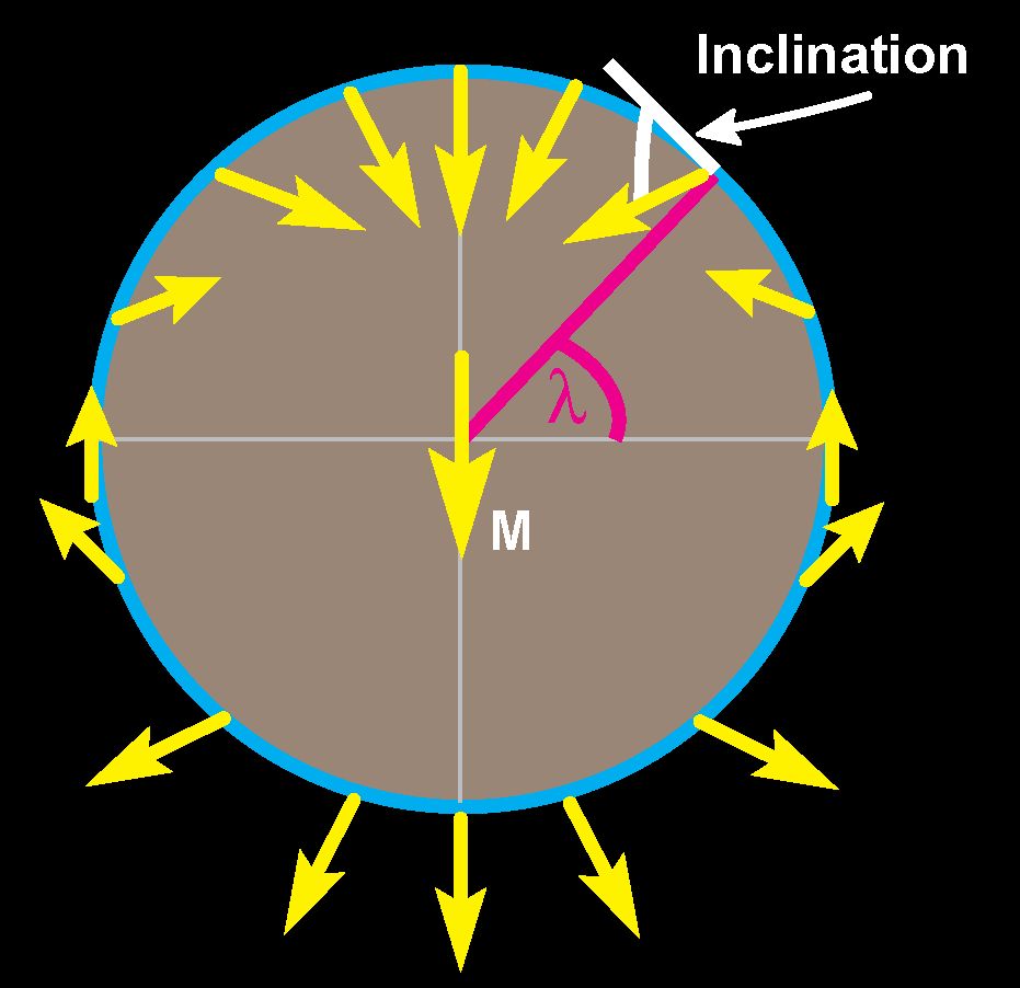
A simplified geomagnetic field redrawn from Robert Butler’s 1992 book “Paleomagnetism: Magnetic Domains to Geologic Terranes“.
Thus, a package of rocks that forms over several 1000s of years at the equator will have a magnetic inclination of zero, whereas a package of rocks that forms at high northerly latitudes will preserve a magnetic inclination that is nearly vertical, and here in Utah, sediments in the Great Salt Lake are preserving a magnetic inclination that is approximately 60°.
The GAD hypothesis is incredibly powerful for tectonic reconstructions, because if you can date the age of a rock well and measure the magnetic inclination preserved in that rock and demonstrate that the magnetization has not be modified since the rock formed, then you can estimate the latitude at which that rock formed. You can imagine doing this for a series of rocks from the same area but of different ages and measuring if and how the latitude of that area has changed with time.
Paleomagnetic methods, based again on the GAD hypothesis, also provide the only way to quantify vertical axis rotations of large blocks of rock in the geological record. Because the declination always points toward the geomagnetic pole, changes in declination through time can reveal how a block of Earth’s crust, such as a chain of islands or a continent has rotated with respect to the pole or neighbouring blocks of crust. We apply these basic assumptions nearly every day in our research on convergent margin and continental tectonics.
A big chunk of your recent work has focused on using palaeomagnetism to decipher the tectonics of Tibetan Plateau. Could you give us a whistlestop tour of your work in that area?
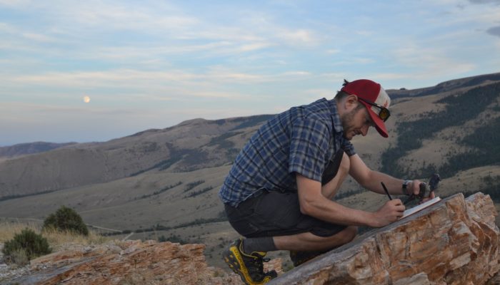
I’ve been very fortunate to work with diverse and varied international teams throughout China. My graduate work began in Central Tibet and has expanded steadily outward since – in both space and time. I was introduced to Tibet by working on the Palaeogene (66-33 million years ago) tectonics of the central Qiangtang Terrane in the middle of the Tibetan Plateau, which at that time hardly anyone else was working on. I then had the opportunity to join a team working on the long-term slip history of the Altyn Tagh Fault, on the northern edge of the plateau and into the Chinese Gobi, and I have since spent three field seasons working in the remote deserts of the Alxa Region of northwest China, most recently with one of the graduate students in my group and a masters student from China University of Geosciences. I began working in Southern Tibet on India-Asia suture zone palaeogeography just as I started wrapping up my dissertation.

Sunset on Mt. Everest & Rombuk Monastery. Credit: Peter Lippert
Through students, postdocs, and my own work, I remain active and invested in each of these regions. In all, I’ve already spent over a year of my life in the high, remote deserts of Western China working with colleagues and students from the US, Canada, Italy, The Netherlands, and several Chinese universities. I can’t say that I have a favorite trip, because each one has its own suitcase of unique memories, but one of the most special was a five week trip to west-central Qiangtang in the autumn 2007, to a very remote region of the plateau. That trip entailed just me, my undergraduate field assistant from Santa Cruz, our guide, and our drivers. The landscape, people, wildlife, and geology were spectacular and rarefied. It was one of the most challenging yet rewarding field seasons I’ve had, and it exemplifies the type of collaborative research and exploration experiences I’m trying to make available to my students and postdocs.
It certainly sounds like your field work has been a highlight of your work! What, would you say, is the biggest finding from your work in the Tibetan Plateau and how does it fit in with the overall geology of the region?
Fieldwork, creativity, and international collaboration are certainly some of the big perks of a career like this. What I regard as our biggest finding is a rather simple one. A large component of my PhD work and the first few years of my first postdoc focused on measuring robust estimates of the latitude of Southern and Central Tibet from 50 million years ago to the present. Our work— and I say our because this has been and continues to be a team effort— demonstrates that the southern margin of the Tibetan Plateau region was positioned at 20°N prior to and at the time pieces of India began colliding with Asia.
This conclusion fundamentally changes the way tectonicists, climate scientists, geodynamists, and paleobiologists think about the India-Asia collision. Previously, much of the community assumed, based primarily on pioneering but outdated and undersampled palaeomagnetic studies, that the India-Asia collision began at 10-12°N latitude and that the most of deformation associated with the collision accumulated in the upper plate of the collision zone (i.e., Asia). Our palaeolatitude estimates require that most of the deformation is instead partitioned into the lower plate of the system, largely by subduction and underthrusting of Indian-associated lithosphere beneath Asia.
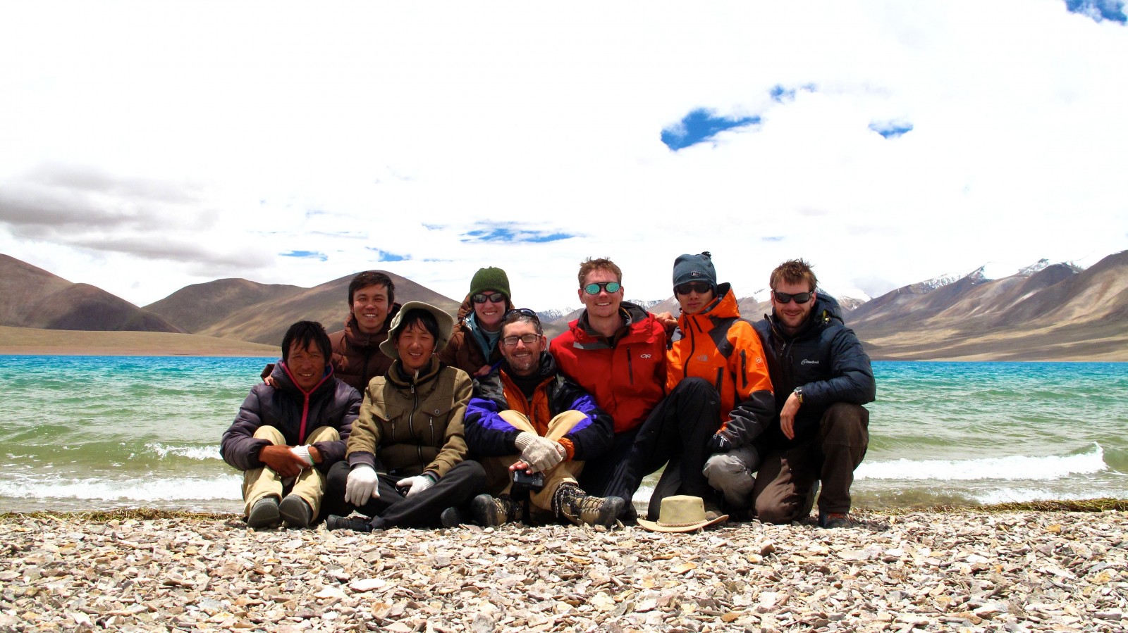
Spring 2011 India-Asia Suture Zone field crew including graduate students from the University of Arizona, Utrecht University, and the Institute for Tibetan Plateau Research. Credit: Peter Lippert.
Moreover, the proto-Tibetan Plateau was located within the high tropics and mostly within the low subtropics at the time collision began and throughout much of its history since. Therefore, we need to reassess how the Tibetan Plateau likely interacted with global atmospheric jets (like the Intertropical Convergence Zone and Westerlies), with important downstream effects on global and regional climate, precipitation patterns in and around the Tibetan Plateau region, physical and chemical weathering and therefore interactions with marine geochemistry, and regional floral and faunal biodiversity. We’re already seeing many different groups critically and creatively addressing each of these topics within this new palaeogeographic framework. By carefully measuring the magnetization of rocks, we can reconstruct a region’s paleogeography, which is, in many respects, a starting point for understanding many Earth System Science processes.
Another big focus of your work is biogenic magnetite. Can you tells more about it and how that fits in with palaeomagnetism?
My research group’s work on biogenic magnetite is quite separate from our research program in convergent margin and continental tectonics, which I love, because that helps keep things fun and intellectually diverse in the group.
Biogenic magnetite represents one of the many ways that rock and mineral magnetism is relevant to so many aspects of Earth System Science. In my group, we study magnetite that is made within the cells of oxygen-sensitive bacteria, so-called magnetosomes produced by magnetotactic bacteria.
Modern forms of these bacteria are genetically diverse, and the shapes of their magnetosomes are also varied, which may be related to the genetic and ecological diversity. We’re testing some of the assumptions that link morphological diversity and the specific ecology of the bugs, as well as methods for in situ magnetic measurements of that morphological diversity, as part of a larger goal of expanding the use of magnetotactic bacteria as biomarkers for specific ecological conditions in aquatic environments.
Simply put, what does the biodiversity of some of the smallest bugs in an aquatic ecosystem tell us about changes in surface processes, such as seasonal run-off, nutrient availability, and temperature, not only today, but also during periods of rapid cooling or warming in the geological record? We work with microbiologists to study these bugs primarily with magnetic measurements, high-resolution electron microscopy, and techniques developed in the materials science and nanotech communities.
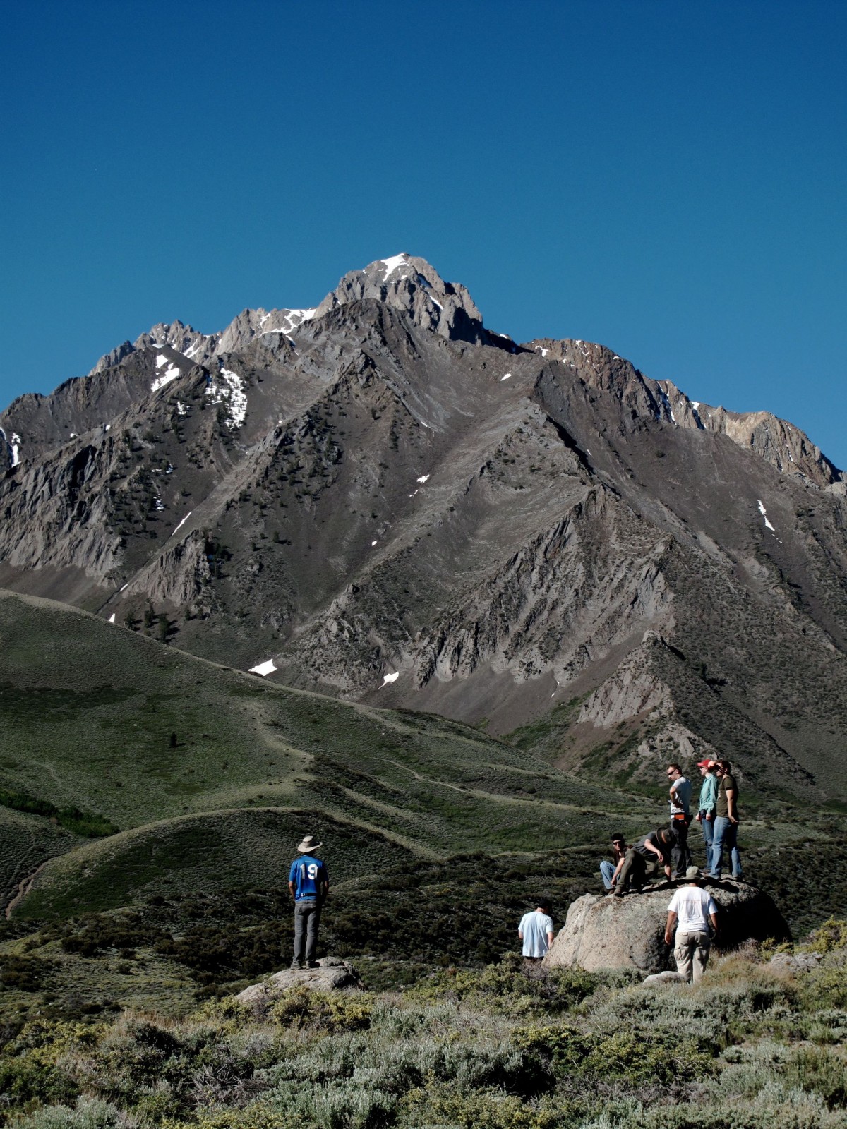
UCSC undergraduate students taking in the neotectonics, glacial geomorphology, and volcanic history of the Mt. Morrison region of the Eastern Sierra Nevada as part of a capstone field class for Earth & Planetary Science majors. Credit: Peter Lippert.
We’ll round off the interview focusing on another reason why you have been recognised with this award: your commitment to mentoring and supervising undergraduate and PhD students. Could you tell us more about why you find this element of your work so important?
I’m compelled to quote Jack Kampmeier, the late Professor of Chemistry at the University of Rochester: “Research is teaching at different levels up and down the spectrum. Sometimes you’re teaching undergraduates, sometimes you’re teaching post-docs or visiting faculty members, but you’re always teaching.” And I would add to this that while teaching, you’re always learning.
As a member of an academic faculty, one of the most important things that I can do is help students learn how to learn for themselves, to give them the confidence and encouragement to use those skills to take calculated intellectual risks in pursuing their curiosity for how planetary processes work and to apply them to making their lives better.
I love the viewpoint and energy that an engaged classroom or lab brings to research and learning. Students, post-docs, and colleagues force us to challenge our assumptions and improve our explanations and models in ways that we cannot do on our own, and thus, working closely with students and fostering an environment in which it’s okay to take intellectual risks and question assumptions is a vital, and thankfully really fun aspect of maintaining a creative research program.