Megan Jamer is a geoscientist from Canada, and an avid cyclist and explorer. Megan is currently travelling around East Africa on bicycle, taking in some remarkable sites and observing first hand the relationship between geoscience and sustainable development. Megan has previously written about agroforestry, landslides, and disaster risk reduction in Rwanda. Her travels have since taken her to Tanzania, and her most recent blog explores geoscience and fluorosis…
It’s hard to ignore Janet’s ‘roasted teeth’, caused by too much fluoride. She’s from Arusha in the north but has moved to central Tanzania, saving for college by managing a small guesthouse. Fluorosis develops gradually, irreversibly damaging teeth and in extreme cases, bones. It’s also a source of stigma and embarrassment, especially when moving to a part of the country where residents have healthy teeth. When Janet offers a smile, it’s restrained.
Groundwater is essential to Tanzania’s—and Sub-Saharan Africa’s—resilience to climate change and waterborne diseases, especially for residents of rural and arid areas. Many Tanzanians already use groundwater for the majority of their daily needs, but fluoride is a major problem. By 2010 estimates, up to ten million Tanzanians were drinking water with unsafe levels of fluoride. It’s a problem that also affects new groundwater drilling programs.
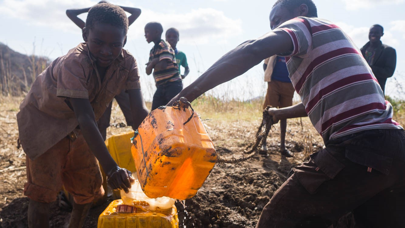
Jerry cans are filled from holes dug into an empty riverbed during the dry season. Compared to these surface water sources, groundwater is more reliable and less polluted by bacteria. Photo author’s own.)
A previous article here on the GfGD blog discussed fluoride in Ethiopia and how to remove it from the water through defluoridation. These technologies are essential, but Principal Hydrogeochemist Pauline Smedley at the British Geological Survey cautions that ‘defluoridation should really be considered a last resort’.
Smedley is emphasizing the preventative work that reduces fluoride’s negative effects, work that geoscientists play an important part in. Defluoridation programs can be better-directed and safer water targeted through understanding fluoride’s distribution. This blog outlines what’s been done to that effect in Tanzania, and the work remaining.
The Risk of Fluoride
In 2008 Tanzania’s national fluoride guideline was lowered from 8 mg/L (ppm) to 4 mg/L, but remains far higher than the WHO (World Health Organization) recommended 1.5 mg/L. Drinking water in excess of the WHO guideline over a long period of time puts individuals, especially children, at risk of developing dental fluorosis. The balance between fluorosis and water scarcity has compelled the Tanzanian government to set its guidelines as it has.
High-fluoride regions in Tanzania have some of the lowest levels of ‘improved’ (safe, year-round, within a kilometer) water access in the country. These regions are generally arid, and their groundwater resources aren’t leveraged as much as they could be. The aquifers are complex, and fluoride adds further risk to drilling programs. A well is abandoned if it exceeds the national guideline.
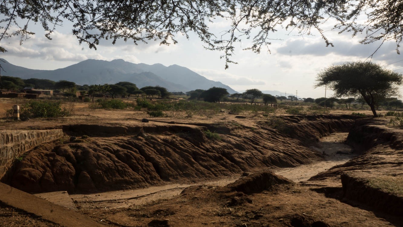
A bridge crosses an empty riverbed in central Tanzania. Photo author’s own.
The challenge and opportunity is that within areas known to have high fluoride, there can also be safe groundwater, as its concentrations can vary significantly even within small areas. If an area is excluded from groundwater development for fear of fluoride, that decision needs to be warranted. Water security is at stake.
Investigating Distribution
In 2002, Smedley and colleagues at the BGS began to investigate fluoride distribution in central Tanzania. Micas, apatite and fluorite seemed to be the primary mineral sources of fluoride in the water. Basement granite containing these minerals is a common rock type on Tanzania’s central plateau, and where fractured it is a significant groundwater target.
Several questions demanded further attention. The relationship between fluoride concentrations and faults was unclear, and faults are a common target for higher flow rates. Significantly, deeper groundwater is generally expected to have more fluoride than shallow or surface water, but within the study area most types of water sources contained high levels—earth dams, rivers, and dug wells included. This did not bode well for predicting distribution based on depth. Because of shifts in the UK’s foreign aid policies, the BGS didn’t investigate further. Instead, more recent understanding of central Tanzania’s fluoride distribution comes from JICA, the Japan International Cooperation Agency. They’ve undertaken to map fluoride as a risk-reduction measure for their continued groundwater development in several regions.
In 2013 JICA reported their key findings, including that ‘there isn’t a difference in fluoride concentration according to geology’, at least not locally. They suggest that fracturing connects the aquifers of different rock types so much so that lithology is insufficient for predictions on a local scale. Even if rock types were reliable enough, the lithology indicated on base maps may not end up being representative of what’s drilled into for a deep (80 meters or more) well.
JICA proposes that topography might play a significant role in fluoride distribution, for its influence on the time groundwater resides in the host rock. In local and regional topographic lows, groundwater may have more time to develop high fluoride concentrations from evaporation and prolonged interactions between water and rock.
Acting On Distribution Studies
Understanding these controls is important, but doesn’t give enough resolution to help choose drilling locations. To address this, an important part of JICA’s strategy is having an accurate database of fluoride measurements, with corresponding information on depth, water source type and the concentrations of other elements affecting water quality. The database is used to make groundwater-prospecting maps that show how faults and existing well performance are spatially related to fluoride concentrations, measured or expected. One of these maps is shown below, guiding drilling decisions in Singida Region, central Tanzania.
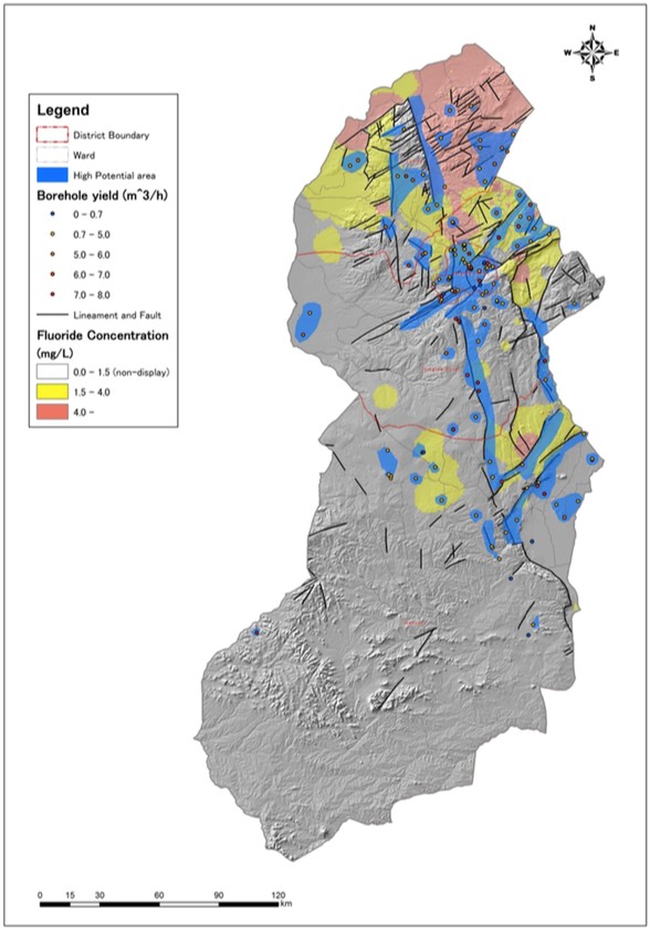
Groundwater prospecting map with fluoride risk areas for JICA’s operations in Singida Region, central Tanzania. From a 2013 JICA report (click on image to open the report).
North of the central plateau, near to Tanzania’s border with Kenya, fluorosis is also a significant problem. This region lies along an arm of the East African Rift Valley, an active continental rift. The granites common to the central plateau give way to the North’s volcanic successions, intrusions and ashes rich in fluorine-bearing minerals. Groundwater in contact with these rock types can acquire very high fluoride concentrations. Other water sources become enriched in fluoride through input from geothermal fluids, or proximity to alkaline (soda) lakes.
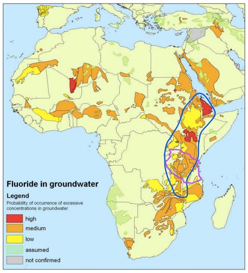
A probability map of Africa showing the likelihood of excessive fluoride in groundwater. In blue are the areas affected by the East African Rift Valley. Tanzania is outlined in purple. Source: Click on image to show the 2004 report that this is adapted from.
In spite of these varied fluoride sources, safe groundwater also exists in northern Tanzania and throughout the rift valley. Recently a team of researchers prospected for a safer aquifer, employing studies of lithology, the type of water coming from springs and groundwater, aquifer flow patterns, fault and fracture networks and the potential for an aquifer to flow, as interpreted from geophysical surveys.
This prospecting led to the drilling of a groundwater well to serve a community with poor water security. The well exceeded the WHO guideline for fluoride but was within the national guideline and compared to other sources in the area, was a safer water point. Learning from these results is one of the goals of FLOWERED, a research consortium focused on defluoridation in the context of climate change, working in different locations throughout the East African Rift Valley.
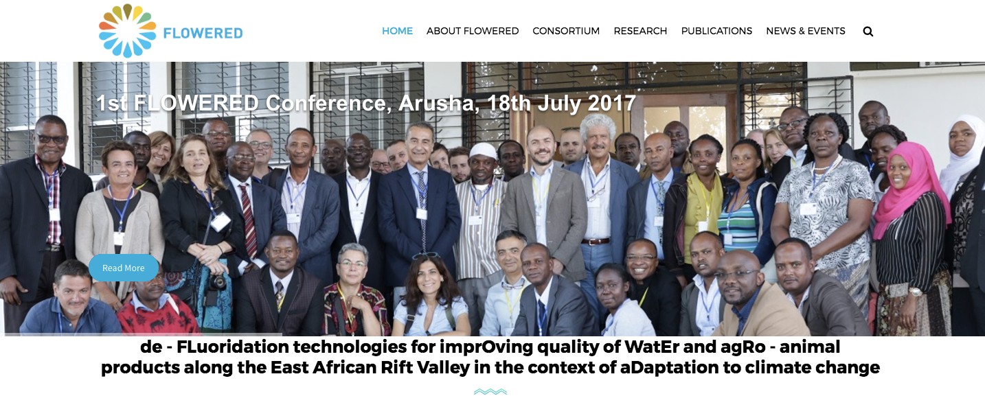
The FLOWERED consortium recently held their first international field trip and workshop in northern Tanzania. Photo taken from their website.
FLOWERED aims to better understand fluoride’s distribution while also implementing defluoridation technologies. This type of coordination is important, because focusing solely on defluoridation limits its effectiveness.
The Limits of Defluoridation
Tanzania currently focuses on bone char defluoridation: animal bones are fired in a kiln and ground to a powder, their calcium absorbing fluoride from water. There are bone char units installed throughout the country, customized to the needs of schools, households and communities.
An effective defluoridation program plans for the population, expected water use, cost, and availability of materials. The programs require caretakers within the community and regular testing to ensure that the process is still removing enough fluoride. With the bone char method, the amount of materials required depends on fluoride concentrations, which can change over time. These are significant obstacles, and currently defluoridation efforts fall far short of what is needed for Tanzanians.
A proactive defluoridation strategy identifies where the problematic groundwater areas are, and why. This is an essential link between distribution and mitigation. ‘Understanding distribution better plays a key role in identifying priority areas for mitigation,’ says Smedley.
In some areas, safe water is simply unavailable and defluoridation is the only option. However, other areas could be prioritized for safe-water prospecting, if they are identified by distribution studies and monitoring to be at risk for extremely high fluoride concentrations, similar to the process followed by the researchers in northern Tanzania.
Any alternative water sources found reduce the burden on defluoridation programs. Even an aquifer with relatively lower fluoride concentrations is beneficial; the lesser the concentrations, the fewer materials needed to make the water safe.
Communication is Key
In Tanzania water resources are managed by a wide range of stakeholders, including community members, government officials, the WASH (Water, Sanitation and Hygiene) sector, donors and NGOs. Communication among these groups is key to addressing fluoride and other water-quality issues effectively.
Existing knowledge needs to be shared among these groups. On this front there are several resources for those with computer and Internet access, including the Africa Groundwater Atlas and these water quality factsheets for Tanzania and other countries. Tanzania’s Water Point Mapping initiative has resulted in a searchable map that can be explored here, and efforts to make a National Fluoride Database are ongoing.
Rural communities have a different reality, with neither electricity nor literacy available to all residents. Here, in-person education becomes essential, as there is a lack of awareness about fluoride and fluorosis that persists today. Fluorosis isn’t life threatening, unlike diarrhoea and other water-borne illnesses, so a community with limited resources may choose to focus on more pressing water-quality issues. Nonetheless, residents need to be equipped with information to make informed decisions.
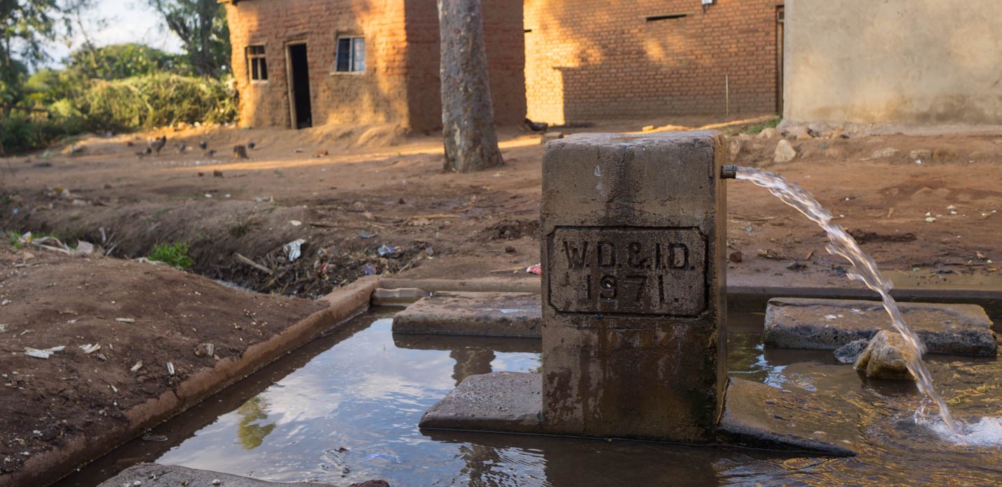
A public water point in central Tanzania. What might the community know about its quality? Photo author’s own.
Communication between different groups is also essential for gathering new data through research. Ongoing projects seem to be recognizing this need for collaboration. In addition to FLOWERED’s multi-faceted approach, JICA’s operations identify fluoride distribution is a key problem to continue studying, and recommend that defluoridation programs only be pursued where alternative safe water isn’t available.
Water sources acquire dangerously high fluoride concentrations because of a particular set of environmental conditions, but fluorosis is an interdisciplinary issue at the intersection of science, public health, culture and water planning. For geoscientists working on this issue, active collaboration with other groups is essential to addressing fluorosis while also improving groundwater access for communities.
**
Geoscience students out there: What do you learn about the connection between fluoride and geoscience in university?
In researching this topic I spoke with WASH (Water, Sanitation and Hygiene) professionals, whose work in the East African Rift Valley includes water quality issues. If there are WASH professionals reading this: What geoscience information do you need to do your job well? How might geoscientists and the WASH sector better collaborate on new research?