Fieldwork is a necessity to expand the brain, to kick-start 3D thinking. Field studies with a specific application in mind have – until now – usually been geared towards hydrocarbon reservoirs. However, with the increasing use of the subsurface, for example for CO2 storage and geothermal energy, alternative field studies gain importance. Here, we will focus on geothermal energy, which is in many countries a prime target of the energy transition. Around half of our energy consumption is simply the need for heat for houses, industry and other applications. Of course, some tectonic settings lend themselves easier to obtaining heat than others. In settings with volcanoes (rift and subduction zones), countries such as Iceland and Italy are frontrunners in developing high temperature (>100⁰C) geothermal energy. No matter which geographic location and which heat source is targeted, all geothermal energy reservoirs consist of the same components. This blog is about the holy trinity of a usable geothermal system: the heat source, the fluid, and the fluid pathways. With this blog, we will take you along on a yearly field trip to discover how outcrops of intrusions can be used to teach BSc, MSc and PhD students about geothermal energy. We go to the Larderello area and Elba. Tuscany, due to the extensional setting, is characterized by a high heat flux, as much as 150 mW/m2 (compared to 40 mW/m2 in most regions). This high heat flux means that it is a prime area for geothermal energy. This trip is organized by Prof. David Bruhn (TU Delft, the Netherlands, and GFZ, Germany), together with the invaluable aid of Prof. Domenico Liotta (University of Bari Aldo Moro, Italy).
Left: Fumaroles and geothermal power plants (with crosscutting pipelines) dominate the view in the Larderello area. Credit: Anne Pluymakers.
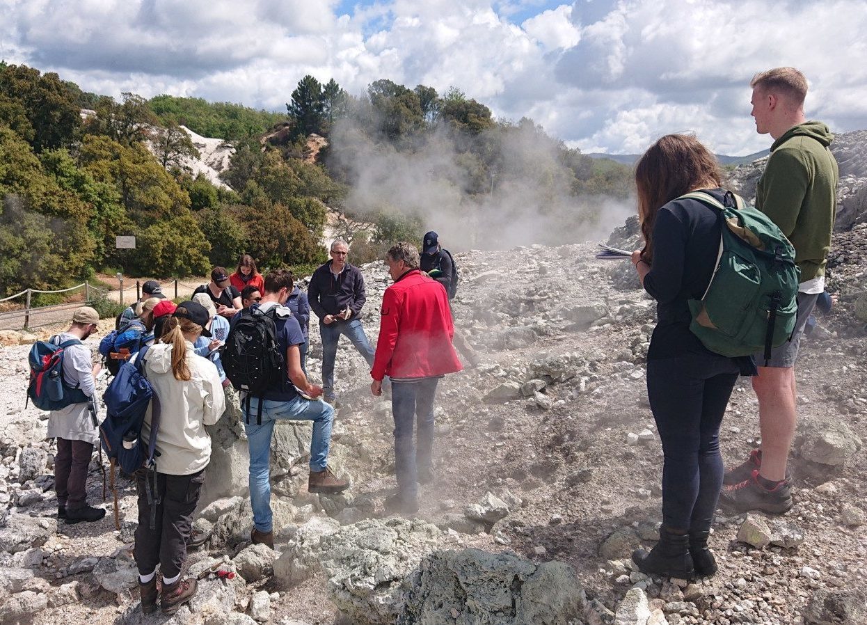
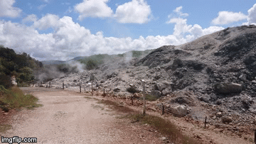
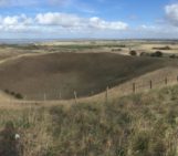
Discussions on top of fumaroles, where steam escapes through fracture networks. Credit: Anne Pluymakers.
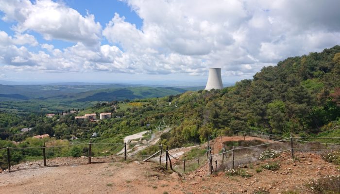
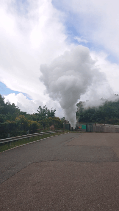
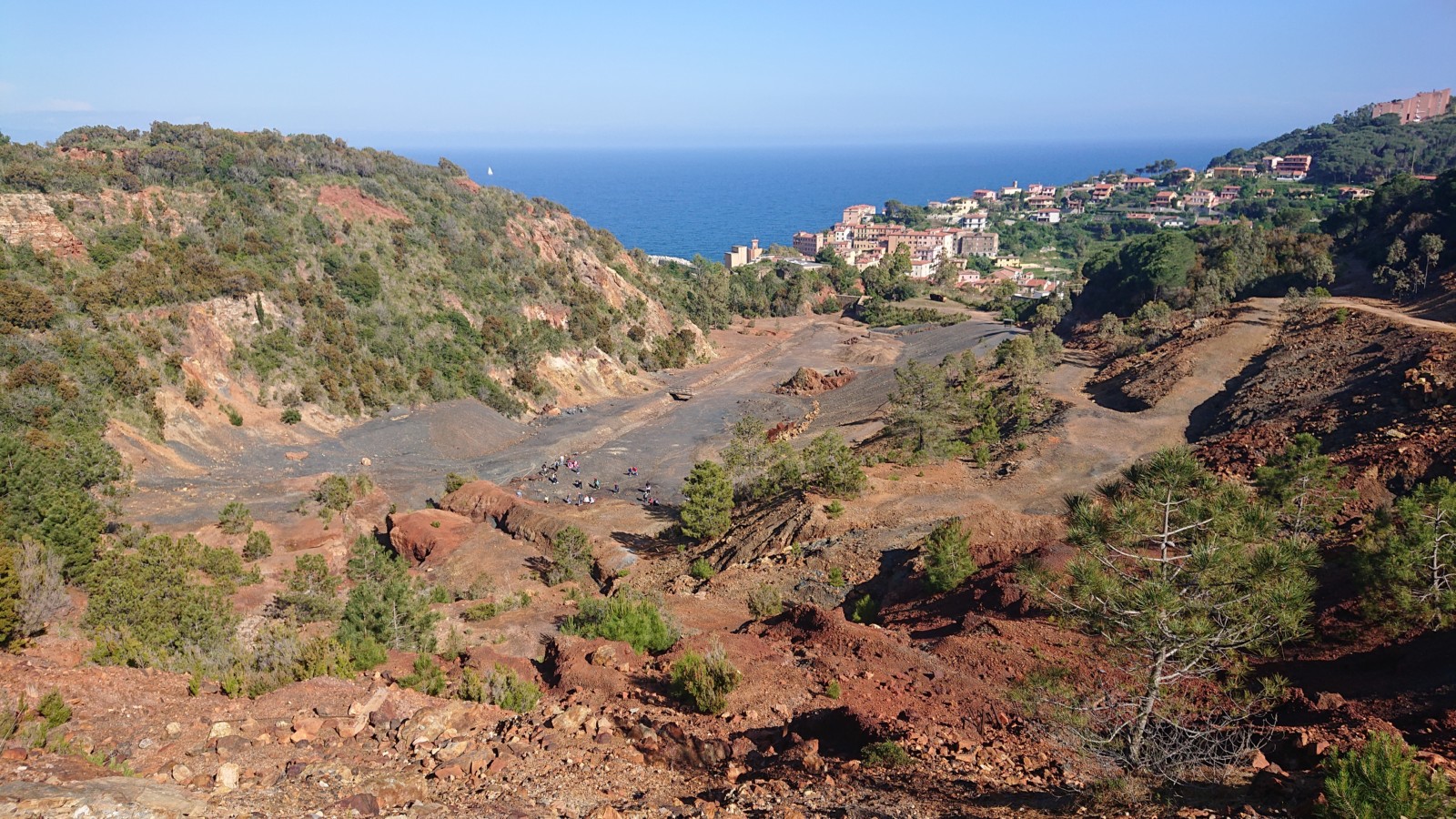
To better understand the technological background, we first explore what a currently active geothermal system looks like. For this, we go to the Larderello area, a beautiful region near the Tuscan coast, on western edge of the Apennines. Here, geothermal energy is visible both through the local presence of fumaroles, as well as by the omnipresent pipelines and cooling towers. The pipelines are sometimes colored green to be less conspicuous. One could find them ugly, but given that they provide 3% of Italy’s energy plus employment throughout the region, they serve a great purpose! In this area abundant heat is present, which is tapped by in total 300 extraction wells and 34 power plants (run by Enel Greenpower). There are another 100 re-injector wells, to ensure the extracted steam and water are re-injected into the aquifers at depth. An example: the geothermal powerplant we visited is fed by 20 boreholes, spread over 7 km2.
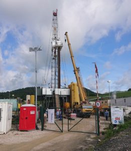
An active drill site in the Larderello area. Credit: Anne Pluymakers
Tourist well: 200°C steam, at 2 bars, and 10 tonnes of steam per hour. Credit: Anne Pluymakers
The two main geothermal reservoirs in this region are (1) a shallow reservoir, with 200°C and 2 bar pressure, and (2) a deep (2 km) reservoir, with the same temperature but then at high pressure, 7 bar (and higher). The heat is carried by steam. The pressures aren’t very high, but the flow rates are enormous. This is demonstrated by the ‘tourist well’, that is now no longer in use. It contains 200°C steam, at just 2 bars – an average biketire carries between 2 and 5 bars. However, this tourist well produces 10 tonnes of steam per hour – so standing on the 85 decibel line it clearly shows the power of the earth! In this region, the power plants function on higher pressure, which renders this specific well not economically viable. Economic interest is an interplay between offer and demand, and as such is location-dependent. In other words, also here it would be technically possible to convert the heat from the tourist well into energy. To go from steam to electricity a turbine and generator are necessary. However, the steam is contaminated with fluids and other gases, which need to be separated before the steam can power the turbine and generator. Precipitation of salts in the water can lead to one of the main production issues associated with geothermal wells: scaling.
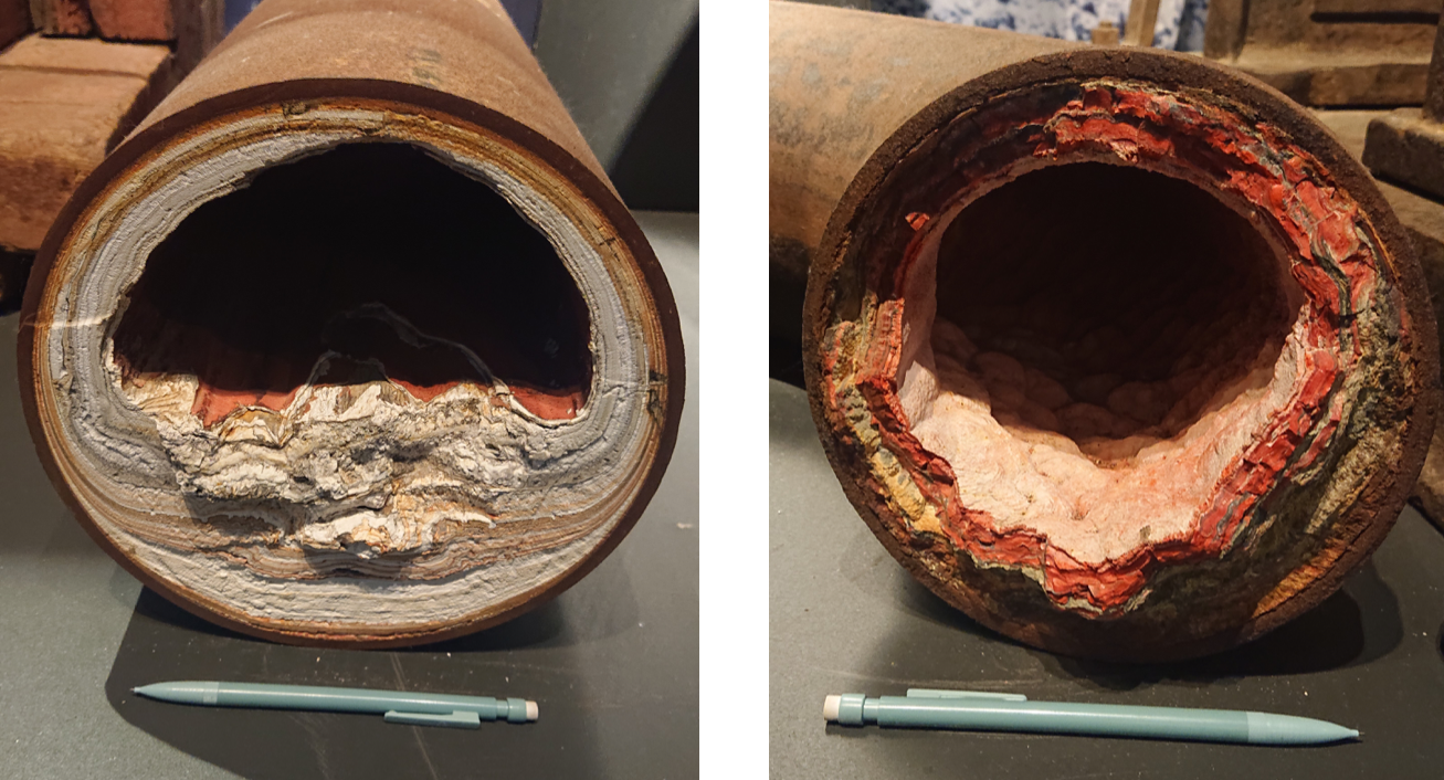
Scaling, or the build-up of precipitate inside pipelines, can be a big issue in geothermal power plants. Credit: Anne Pluymakers.
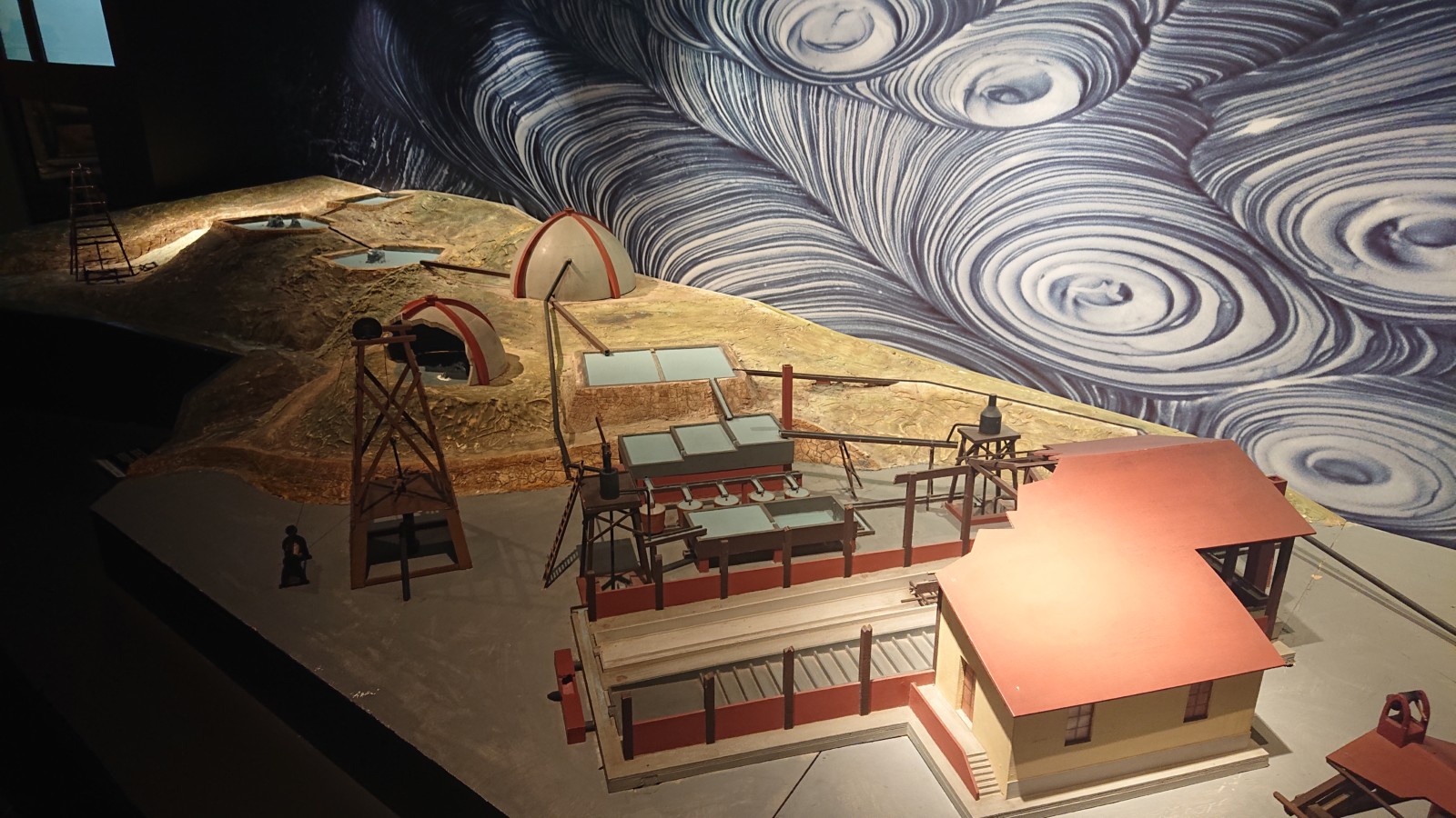
Scale model of the first “hot pond under cover” for boric acid extraction, where the boilers were powered by steam (display in the Geothermic Museum of Larderello, photos by Anne Pluymakers)
Fun fact: the first use of geothermal waters in the region was to produce boron salts. Production of boric acid and its sodium salt, borax, started as early as 1818, though mass production initiated in 1827. Francesco Larderel built a covered hot pond to gather natural steam, needed to feed the boric water evaporation boilers. By the start of the 20th century, the Larderello region produced electricity for local use.
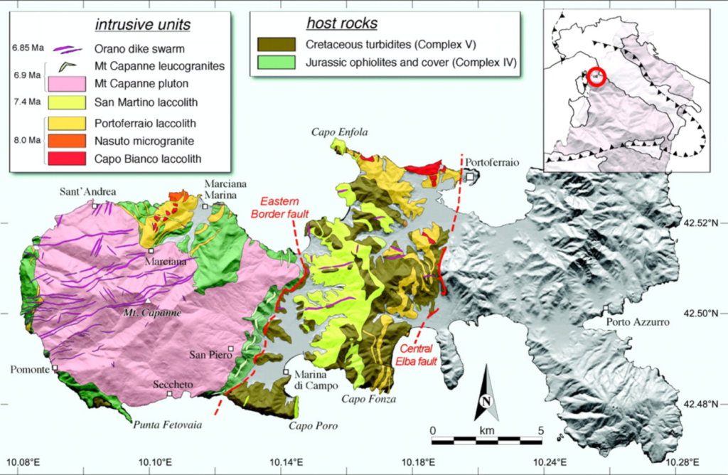
Geological map of Elba island (from Rocchi, S., Westerman, D. S., Dini, A., & Farina, F. (2010). Intrusive sheets and sheeted intrusions at Elba Island, Italy. Geosphere, 6(3), 225–236. https://doi.org/10.1130/GES00551.1)
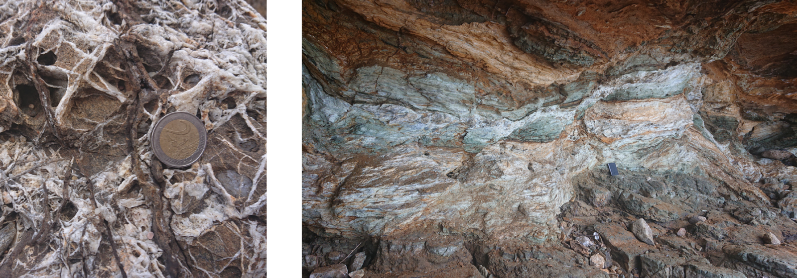
After this demonstration of a working geothermal system at the earth’s surface, the excursion moves on to the geological analogue. Analogue field studies are a common way of imagining what the subsurface could look like in the targeted region. Therefore, we move to the island of Elba, just off the coast of Tuscany. The equivalent heat source is the Monte Capanne pluton, on the west of the island. The first evidence of geothermal activity constitutes of precursor dike and sill intrusion into an ophiolite sequence. Large scale melting happened in the Miocene, at a depth of 6 to 7 km. To generate these volumes, water had to be present – this geological evidence then represents the ‘mother’ of the heat flux, and where the first geothermal fluids on Elba have come from. In the outcrops of the Monte Capanne pluton xenolites and large feldspar crystals are visible. The feldspar crystals indicate large convection patterns in what must have been viscous, cooling magma. After cooling, this pluton was fractured, and meter-sized mafic intrusions with fine-grained crystals share orientations with these fractures. Analysis of fluid inclusions in the outcrop indicate that the fluids are all relatively local. That is not surprising, since upon cooling, felsic magmas release large amounts of water, and also the surrounding meta-sediments (i.e. former ocean floor) were full of water.
Where there is a magma, there are interesting percolating fluids, with all kinds of rare and precious minerals. As can already be seen in the geological map, the evidence of fluids is obvious throughout the island, in the form of several mines, especially on the east side. In the east, the people have mined for iron for decades, specifically for hematite, limonite, pyrite, magnetite and ilvaite. Of these, ilvaite is a mineral that is quite specific to Elba. On the west, closer to the pluton, we can find tourmaline, beryllium, orthoclase and quartz.
Mine on Elba island. The elongated shape follows the fault path. Credit: Anne Pluymakers
Many of these mines follow distinct pathways: those of fractures and faults, demonstrating also in this fossil system the importance of fractures and faults as fluid pathways (i.e. compare the photo of the small scale fracture network on Elba to the photo of the fracture networks associated with the fumaroles). Elba hosts a famous shear zone: the Zuccale fault. This outcrop contains many textbook structures, from brittle to ductile deformation.
The less weathered mineral veins provide clear evidence of past fluid pathways. A key message for geothermal energy recovery that can be obtained from outcrops like these, is that permeability is directional and local. The fracture zone itself is asymmetric along the shear zone. The shear zone is impermeable across fault, but not necessarily as impermeable along the fault. As an engineer responsible to determine the best location to drill a well (approximately one million euro per km!), where would you go?
Brittle (left) and ductile (right) deformation at the Zuccale fault outcrop. Credit: Anne Pluymakers.
An earlier version of this blog appeared on the Focus on vips blog. This is a slightly modified version.

georg wallner
As an “engineer responsible to determine the best location to drill a well”, shouldn’t you consider also environmental and social issues? Like pollution, seismicity, destruction of landscape and social structure …
Elenora van Rijsingen
Dear Georg,
I consulted the author and this is her reply to your question: ‘I fully agree, in this day and age I personally feel that as an engineer you should consider technical (so including the geology) aspects as well as social aspects. This is at TU Delft also one of the aspects highlighted in the educational program’.
I hope it helps!
Knowledge Sourcing
Geothermal energy is less spread out as compared to other renewable sources since not all territories hold large pockets of trapped heat in their subsoil.
Anne Pluymakers
Absolutely, all renewable energy sources have their time and place where they are most effective. Everywhere on Earth, when you drill a hole it will become warmer than at the Earth surface. How much warmer is strongly location-dependent, and as such, indeed the volcanic areas, have higher potential for geothermal energy and therefore also a longer history. Did you know that in the Netherlands there are several greenhouses heated with low enthalpy geothermal heat?