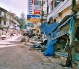
Nine months ago the ground in Nepal shook, and it shook hard: on April 25th 2015 the M7.8 Gorkha earthquake struck and was followed by some 250 aftershocks, five of which were greater than M 6.0. The devastation left behind in the aftermath of such an event, and how to coordinate disaster-relief efforts in a vast, mountainous region, is difficult to imagine. Yet, this December at the 2015 AGU Fall Meeting, I came a little closer.
At the meeting I attended the press conference ‘Future Himalayan seismic hazards: Insights from earthquakes in Nepal’. It focused, mainly, on the outcomes of two research papers published in Science on the role that both past and the recent Gorkha earthquakes can play in triggering quake-induce landslides. The findings of the research were covered widely by the media.
I was struck, not only by those findings, but by the personal accounts of the scientists who’d seen the devastation left behind by the earthquake. But more still, what really caught my attention, was the multinational effort and collaboration that went into the research.

Before-and-after photographs of Nepal’s Langtang Valley showing the near-complete destruction of Langtang village due to a massive landslide caused by the 2015 Gorkha earthquake. Photos from 2012 (pre-quake) and 2015 (post-quake) by David Breashears/GlacierWorks. Distributed via
NASA Goddard on Flickr. Click to enlarge.
After the press conference I met with Dalia Kirschbaum of the NASA Goddard Space Flight Centre and Dan Shugar of the University of Washington Tacoma, two of the co-authors of the 2015 Gorkha earthquake paper, to discuss this aspect of the research in more detail.
Given the vast geographical area over which the Gorkha earthquake had caused damage, as well as the hard-to-access mountainous terrain, the team used satellite imagery to map earthquake-induced landslides. They also monitored the stability of the region’s moraine dammed glacial lakes, prone to outburst following earthquakes due to the failure of moraine damns.
When a large scale disaster occurs the International Charter on Space and Major Disasters allows for the dedicated collection of space data to contribute towards humanitarian and charitable efforts in areas affected by natural or man-made disasters. Following the Gorkha earthquake, Nepal called for the activation of the charter.
Following Nepal activating the Charter, satellite imagery was provided by NASA, the Japan Aerospace Exploration Agency, the China Space Agency, as well as private organisations such as DigitalGlobe, to name but a few.
This project was “different to what we had seen in the past in terms of international collaboration,” Dalia told me during our conversation.
A group of nine nations, coordinated by the Global Land Ice Measurements from Space, began assessing the imagery provided and mapping the earthquake-induced geohazards, including landslides. In the first instance the data was used to identify potentially hazardous situations where communities and infrastructure might be at risk. This was followed by an effort to build a landslide inventory, which could provide information about the distribution, character, geomorphological, lithological and tectonic controls which govern the occurrence of earthquake triggered landslides.
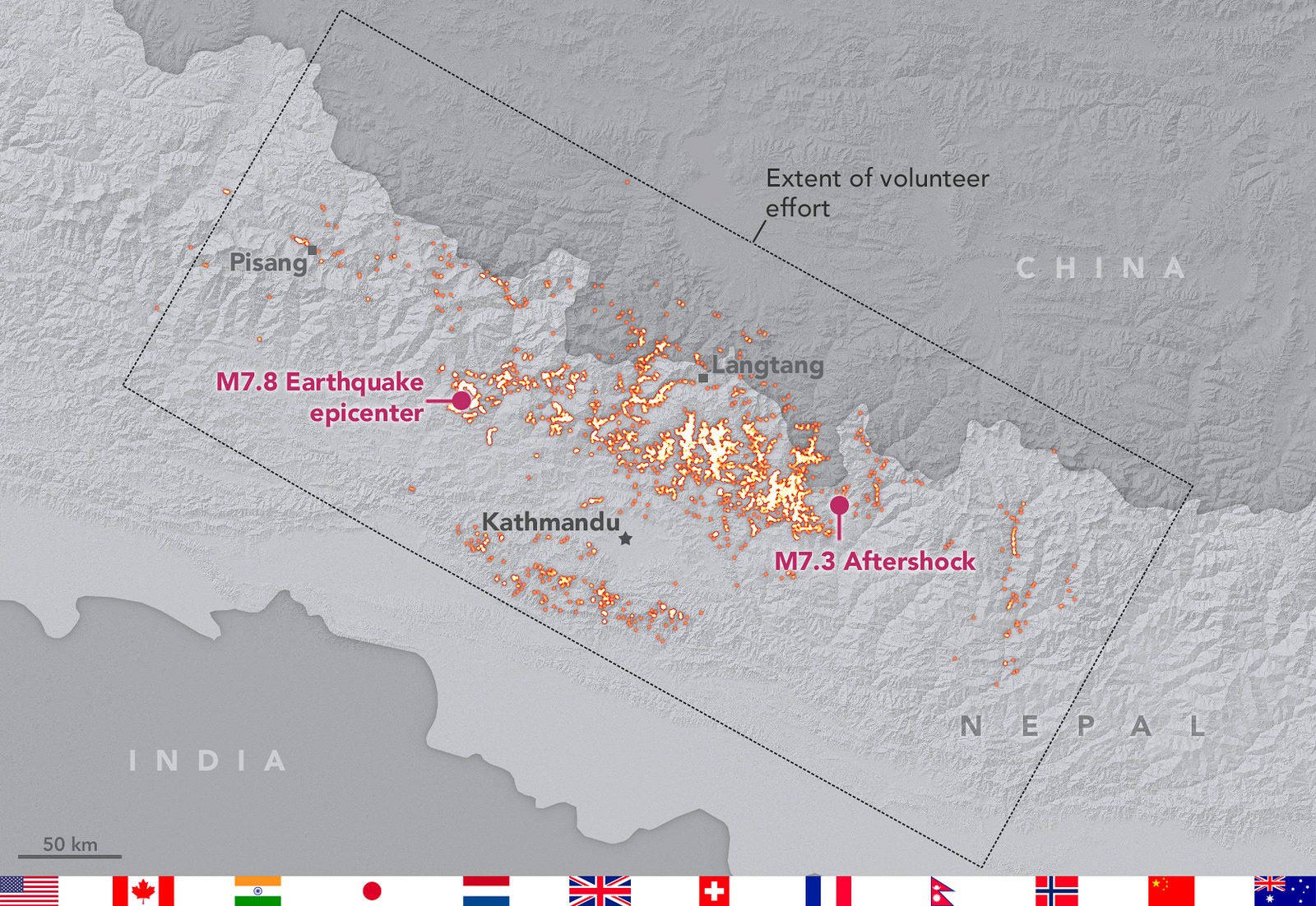
An international volunteer geohazards team mapped landslides triggered by the 2015 Nepal Gorkha earthquake and its aftershocks. The landslides were mapped using a range of different satellite products. Credit: Landslide mapping team/NASA-GSFC. Distributed via NASA Goddard on Flickr.
Simultaneously, scientists from the British Geological Survey and Durham University also began to build a database of known geohazards in the region. The data was shared between the two working groups.
“For no other major earthquakes have landslide inventories come from such a diverse range of datasets and organisations,” explained Dalia.
Neither had emergency remote sensing been undertaken so quickly.
I was interested in why the Nepal earthquakes in particular had inspired this, so far unique – but hopefully not the last – diverse international collaboration to better understand earthquake-induced geohazards.
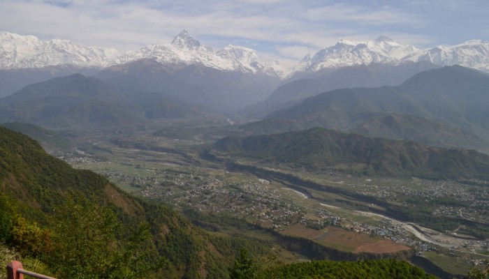
Dan Shugar thinks it was because so many geoscientists have a deep personal connection with Nepal. Durham University scientists, for example, take geology students to the region on an annual field trip.
“Everybody loves Nepal! The nature of the country really lent itself to people wanting to help,” he added.
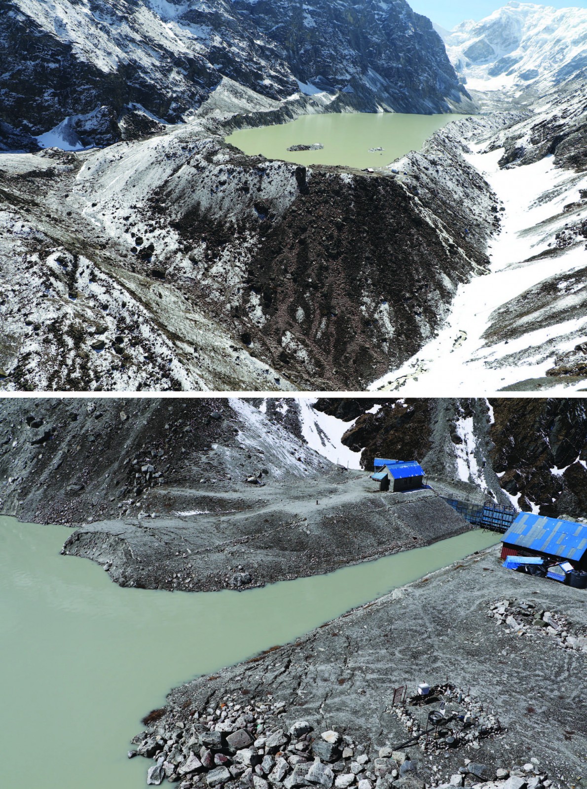
Field visit identifies light damage at Tsho (lake) Rolpa. Post-earthquake image of Tsho Rolpa appears identical to its appearance shortly before the earthquake. Two areas of fractures —believed formed by the May 12 2015 aftershock— were observed on the engineered part of the end moraine from a helicopter during an inspection undertaken by the U.S. Geological Survey at Tsho Rolpa. Photos from 27 May by Brian Collins/USGS, courtesy of USAID-OFDA (Office of Foreign Disaster Aid). Distributed via
NASA Goddard on Flickr.
For many, including Dan, it rose from a need to contribute to the humanitarian effort. Despite having trained as a geomorphologist and actively researching Alpine natural hazards, prior to the Gorkha earthquake he’d not had the opportunity to apply his knowledge and expertise to help others. It allowed him to offer help in the same way a medic might do by flying out to the scene of a disaster and offering medical expertise and treating the injured.
For Dalia, the positive impact made in the Nepal crisis by the international effort of quickly gathering, sharing and interpreting Earth observation data, was an important driver in keeping her linked to the project.
This effort is now seeing a life beyond the Nepal earthquakes. NASA satellites had previously been involved in the acquisition of data sets to aid in humanitarian crisis, such as in the aftermath of hurricanes. The successful approach taken during the Nepal earthquakes will now help coalesce NASA’s disaster programme and how NASA will respond to natural hazards in the future. It is leading to a more formalised disaster response programme.
The lessons learnt from the Nepal earthquake are ongoing, with much still being done in the scientific realms to better understand the hazards posed by the tectonics of the region, and associated geohazards triggered by the earthquakes. Many of the international collaborations fostered during the crisis are ongoing and will hopefully mean an improved response to future natural hazards in the region.
By Laura Roberts Artal, EGU Communications Officer. With many thanks to Dalia Kirschbaum and Dan Shugar.
References
Schwanghart, W., Bernhart, A., Stolle, A., et. al.,: Repeated catastrophic valley infill following medieval earthquakes in the Nepal Himalaya, Science, vol. 351, 6269, 147-150, doi: 10.1126/science.aac9865, 2016.
Kargel, J. S., Leonard, G. J., Shugar, D.H., et al.,: Geomorphic and geologic controls of geohazards induced by Nepal’s 2015 Gorkha earthquake, Science,vol. 351, 6269, 147-150, doi: 10.1126/science.aac8353, 2016.
Unfortunately, some of the publications referenced in this post are close access – but other links included in this post, as well as the post itself, hopefully convey the overall message of the research.