Welcome to Taroko National Park. Would you like to borrow a safety helmet? In this precipitously steep landscape, covering one’s head is strongly encouraged.
Rockfalls and landslides, triggered by frequent seismic activity and torrential rainfall, are mainstays in Taiwan’s preeminent national park. Evidence of this mass-wasting is everywhere: roadways are littered with fallen rocks, boulders choke riverbeds, and raw slopes denuded of vegetation tower above hiking trails. I’m a science journalist, and I traveled to Taroko National Park to report about landslides. My trip was supported by the EGU Science Journalism Fellowship.
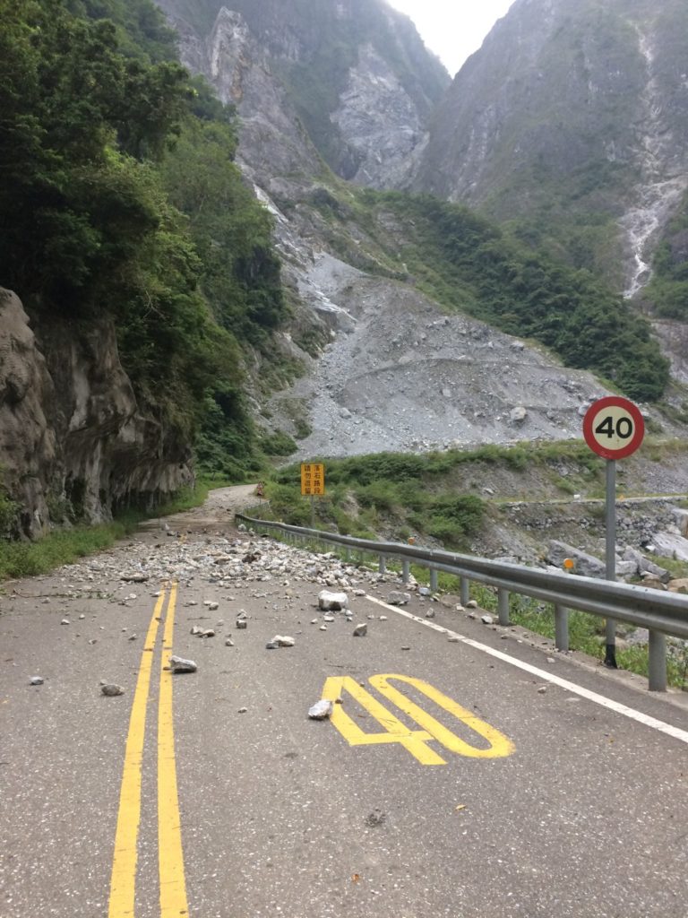
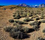
Rocks litter an unused road in Taroko National Park. A scar from a 2013 landslide dominates the background. Image courtesy of Katherine Kornei.
A Growing Landscape Dynamics Observatory
In October 2019, I spent a week in Taroko National Park with a team of scientists from German and Taiwanese institutions. The researchers, led by Niels Hovius and Jens Turowski of the GFZ German Research Centre for Geosciences in Potsdam, were scouting locations to place water sensors, water flow gauges, seismometers, weather stations, and cameras. These instruments will become part of a growing landscape dynamics observatory that’ll eventually stretch across a wide swath of Taroko National Park: Hovius and Turowski and their colleagues have already installed about 60 instruments, and they plan to add roughly 60 more over the next 18 months.
The data the team is collecting—including geophysical, hydrological, seismological, and chemical measurements—will shed light not only on landslides as hazards but also how they play important roles in the carbon cycle, which determines Earth’s habitability. The overarching goal of this observatory, said Hovius, is to holistically understand how matter cycles through an ecosystem. “I’m very interested in seeing how landslides act in connecting different parts of the system.”
From the Mountains to the River
From our hotel within Taroko National Park, we set off each morning on the park’s serpentine main road. (Those of us with stronger stomachs were relegated to the back of our silver 10-seater van.) Sometimes we drove up into the mountains, climbing in elevation until we emerged into a chilly, moss-covered landscape worlds apart from the tropical humidity we’d left behind. High in these mountains, the team is planning to install a rain radar that’ll record precipitation over the entire park. Other days we drove along tributaries of the Liwu River, frequently going on short hikes to get a closer look at recent landslides or to assess a bridge’s suitability for supporting instruments.
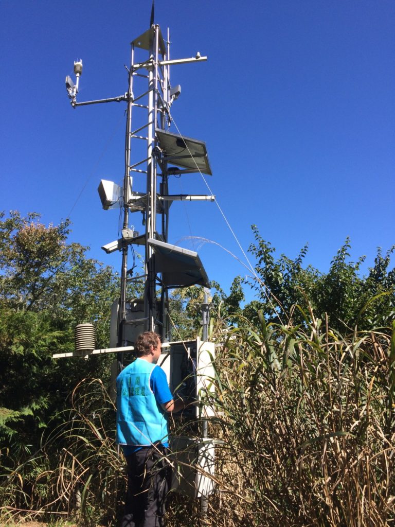
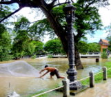
Jens Turowski checks a weather station in Taroko National Park. Image courtesy of Katherine Kornei.
Landslides as Hazards and Chemical Reactors
This observatory will detect landslides in multiple ways: seismometers will record the ground shaking caused by moving rocks, and cameras will capture images and videos. Hovius and Turowski plan to share these nearly real-time detections with park officials, who can then make informed decisions about closing roads or hiking trails.
The team also wants to better understand landslides’ roles in the Earth’s carbon cycle, which regulates the planet’s ability to support life. Previous research has shown that landslides are important agents of chemical weathering, the breakdown of rock into life-important nutrients like sodium and potassium. But some chemical weathering pathways release carbon dioxide into the atmosphere while others draw this key greenhouse gas down into geological storage, essentially locking it away for millions of years. Which pathways dominate in Taroko National Park? How do the relative contributions of different pathways change over time and in different environments? These are some of the questions this observatory hopes to answer.
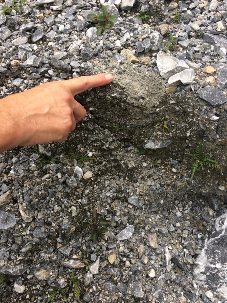
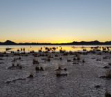
Landslides pulverize rock, increasing the amount of surface area available for chemical reactions. Image courtesy of Katherine Kornei.
Plenty More Questions
There are other possible research threads, too. Work in Taiwan and elsewhere has demonstrated an uptick in the landslide rate after an earthquake. But rates consistently return to normal levels within a year or two. How do landscapes knit themselves back together? Does the re-establishment of plant roots, for instance, help keep slopes intact?
Landslides also mobilize organic matter—leaves, tree trunks, small twigs—toward rivers, where this material can be carried to the ocean and buried. If this transport occurs rapidly enough, organic matter is sequestered before it decays, effectively drawing down carbon. What properties of landslides are linked to rapid burial of organic matter?
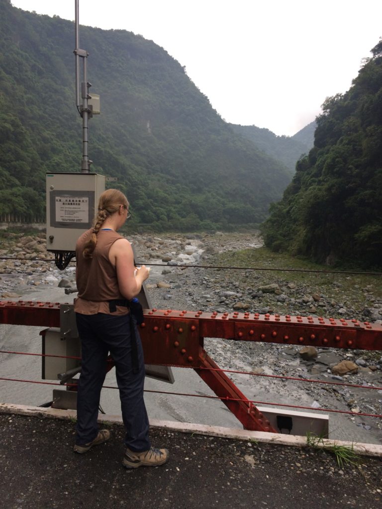
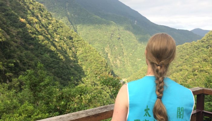
I’m taking notes near one of the observatory’s instrument clusters on a bridge. Image courtesy of Katherine Kornei.
Hovius and Turowski and their colleagues are keen to answer these questions and many others. It’s good that the observatory will remain in place for at least a decade, Hovius says, since it’ll constantly evolve as additional scientific questions arise. “This thing will never be complete.”
By Katherine Kornei
Katherine Kornei is a science journalist living in Portland, Oregon in the United States.