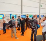
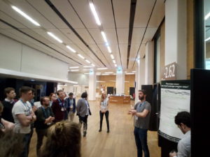
At the EGU General Assembly 2019 last month, if you walked through the dark basement and the most distant hallways of the convention centre, into room -2.62 on Wednesday evening, you may have heard people introducing themselves followed by the words “… and I have a problem.” This may have sounded like a support group. In fact, if you had entered the room it would have been clear that you had just walked into a kind of support group – a scientific one. In the Crowd-solving Problems in Earth Sciences short course scientific, career-related and logistical problems were shared and discussed.
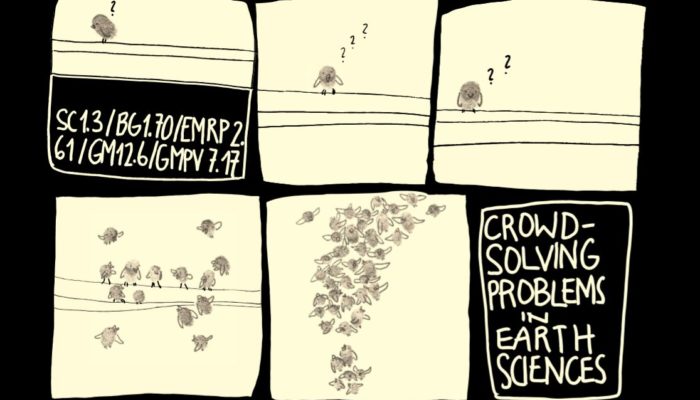
After the success of last year’s ‘Crowd-Solving problems in Earth science research’ session, a group of young geomorphologists decided to organize a second crowd-solving session at the EGU 2019 meeting, but this year for a broader audience, covering various EGU divisions (including Biogeosciences, Earth Magnetism & Rock Physics, Geomorphology, Geochemistry, Mineralogy, Petrology & Volcanology).
This short course aims to provide a platform especially, but not exclusively, for early career scientists (ECS) to network and brainstorm with fellow researchers. Discussing the challenges you face in your research among your peers may help you to find the core of the problem, a path to the solution, or even other ECS that face similar problems and may become your fellows in the search for an answer.
-
- Credit: Johannes Buckel
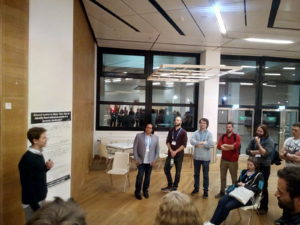
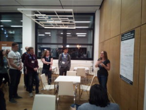
Despite the unlucky scheduling of the session (from 19:00-20:30) 35 scientists participated this short course. In this blog, we summarize the problems highlighted in the event and share the discussions, ideas and solutions that emerged from the brainstorming session with those who didn’t find this safe place at the EGU General Assembly and the wider EGU community.
Fatherhood and parental leave: How to balance career and family in the 21st century?

Fatherhood and parental leave: How to balance career and family in the 21st century? Credit: Johannes Buckel
(Samuel Wharton, University of Leicester, United Kingdom)
One of the most important events in a man’s life is the day when he becomes a father. During these special times, it is inevitable that young fathers still want to spend time with their new-born child. However, in science, new fathers are usually early career researchers on temporary contracts and the paternity leave offered can be poor, as little as a few days to week. Thus, new fathers can often be torn between wanting to take time out to be with their child and the battle to retain job security for their new family. As a result, the majority of childcare is provided by the partner, who often ends up sacrificing their own career ambitions.
In the discussion, we found that the underlying problem is that scientific environments are built on short term contracts. This conflicts with the need for paternity leave to be more flexible, allowing men to take up to six months leave if necessary and to accommodate their partners’ ambitions. Therefore, taking time out should be considered in both partners’ CVs, so that they are not punished in their careers for producing less papers, for example. Most importantly, future fathers should not be afraid to proactively talk to their partners, supervisors and colleagues about the expectations that are placed upon them. The enjoyment of fatherhood, if granted time, could be for the benefit of every scientist.
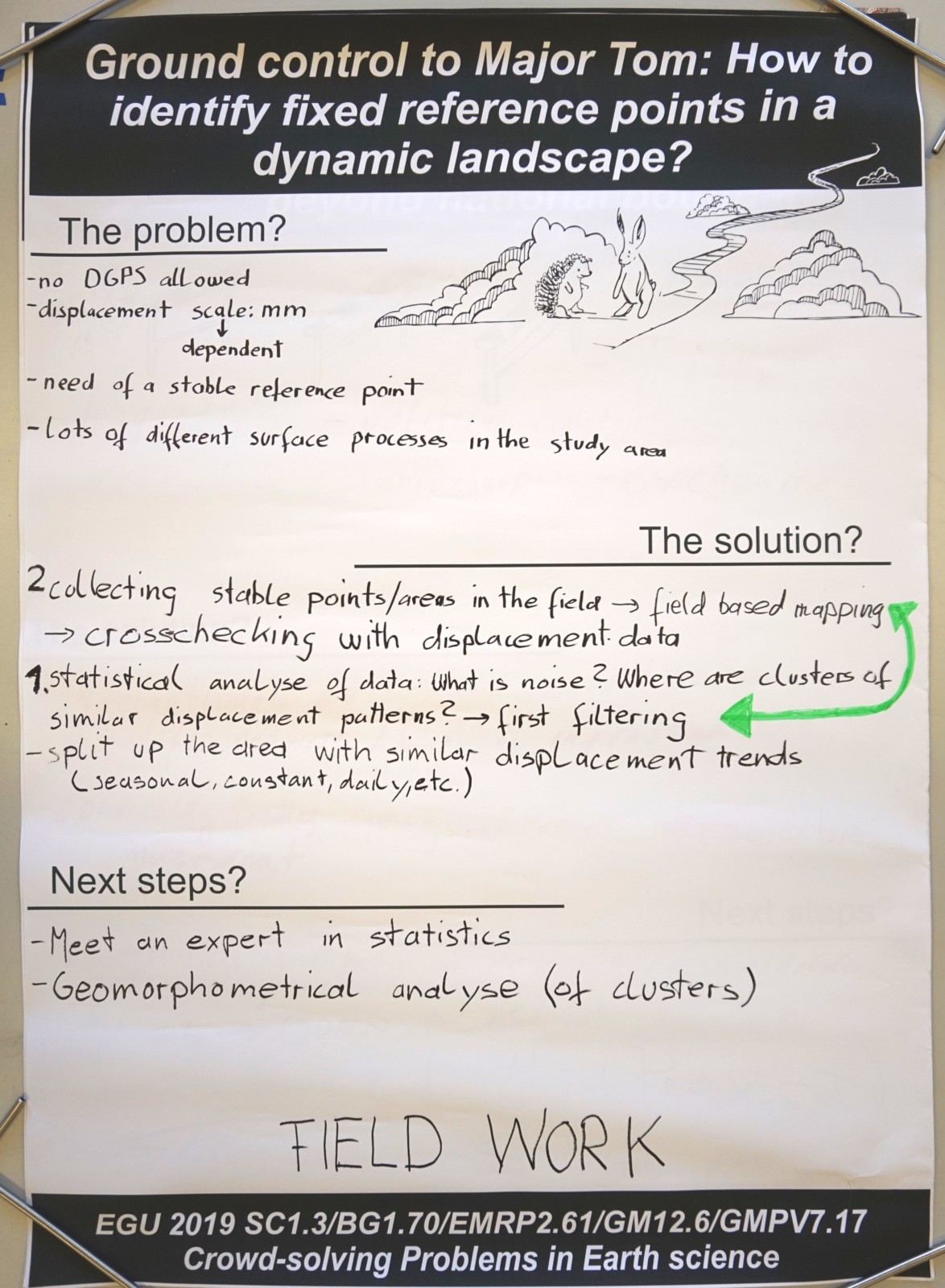
Ground control to Major Tom: How to identify fixed reference points in a dynamic landscape?
(Eike Reinosch, TU Braunschweig, Germany)
Ground control to Major Tom: How to identify fixed reference points in a dynamic landscape? Credit: Johannes Buckel
When using satellite data in research, finding reliable and fixed reference points is essential for analysing how an object or surface moves over time. Without a reference point, the satellite data is much like ‘Major Tom’ from David Bowie’s song ‘Space Oddity’: Helplessly floating in space. Choosing a bad reference point however, could make all results invalid and completely useless. But how can we be certain, that the points we choose are reliable, even in a highly dynamic study area?
Luckily we crowd-solved some ideas and suggestions. As a first step, we can use the data available to perform a preliminary selection of reference points following a few criteria: the selected points must feature a stable backscatter signal of the satellite radar waves over time, be present and clearly visible in all images, be far away from moisture sources which could disturb the signal and, if possible, be located on bed-rock material. A second step would be to perform a statistical clustering of areas based on similar patterns and features to ensure that results are comparable.
However, during the discussion we realized that while a statistical evaluation of reference points is absolutely essential, it is just as important to verify those reference points in the field. Following field observations of potential fix points the data needs to be reprocessed with remaining reliable reference points. This should produce the best grounded result possible.
Crowdsourced data: How to use citizen science to study natural hazards in remote areas?
(Joanne Wood, King’s College London, UK)
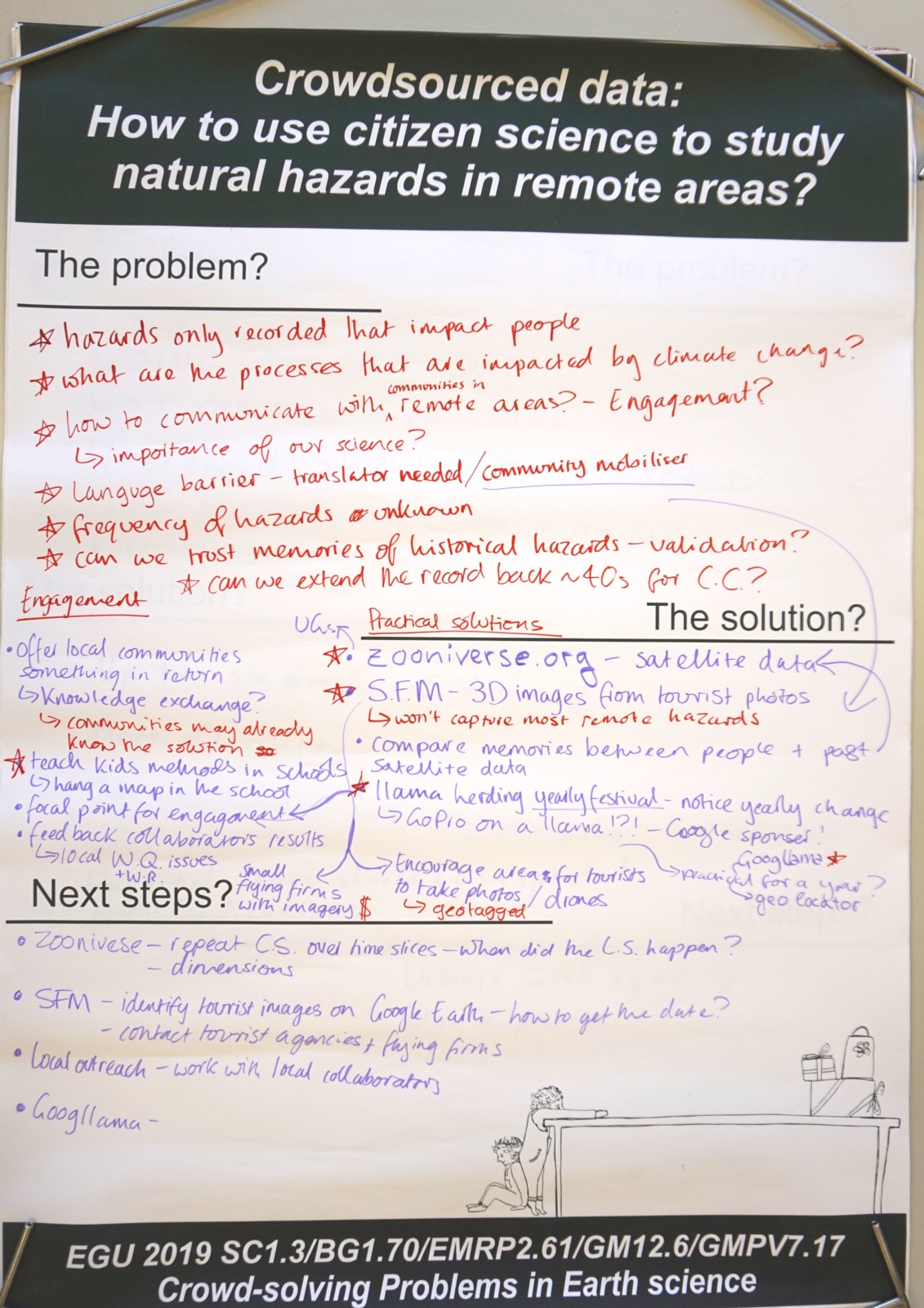
Crowdsourced data: How to use citizen science to study natural hazards in remote areas? Credit: Johannes Buckel
Researching natural hazards in remote locations can be a challenge. Natural hazards are often only recorded if they impact humans, so records do not accurately reflect the quantity or frequency of hazards in remote regions. This means data for research into natural hazard frequency in remote regions is often incomplete.
In the brain-storming session, we talked about how citizen science provides an opportunity to bridge this gap in data availability. One of the notable outcomes of the session was the idea that citizen scientists, from children to grannies, could inspect satellite imagery from remote areas to identify the location and timing of natural hazards using online platforms. This could be supplemented with local knowledge by engaging with remote communities to map events as they happen and to help pinpoint events that have happened in the past.
We also came up with other creative sources of information, such as utilising tourist photos for high temporal resolution monitoring and even strapping cameras to animals (llamas were suggested for Jo’s case study of Peru) to access the most remote locations.
Communicating science to the public: Are we missing something?
(Stacy Phillips, The Open University, Milton Keynes, UK)
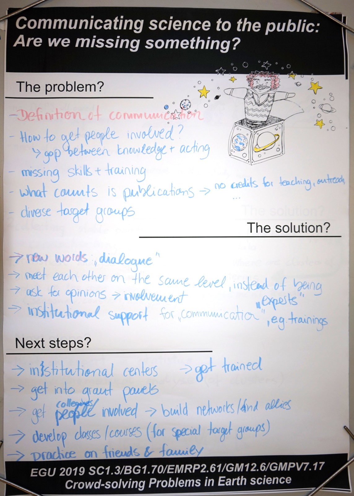
Communicating science to the public: Are we missing something? Credit: Johannes Buckel
Science communication events are becoming increasingly common and more scientists are now feeling the need to communicate science to the public. However, the parts of the public that participate in science communication events are often self-selective groups that are already interested in science. How can we reach an entire cross-section of the public?
In the discussion we didn’t find a unified approach which would enable us to reach out to the entire public, but rather decided that knowing your audience was key, that each group is different and requires a different communication style. We should remember that we, as scientists, are part of the public, and instead of ‘communicating to’ the public, we should be ‘engaging with’ the public, having two-way conversations and getting them actively involved.
Good science communication however is hard, and requires time and expertise to get it right. To improve public outreach in the future, we first need to train our scientists in communication skills at an early career stage. Science is all about communication, making such skills beneficial for your entire career. Outreach work also needs to be valued at an institutional level, required on academic CVs, and incentivised in career pathways, in order to reward those who are passionate and who excel in science communication.
Sharing is caring: How to improve accessibility to scientific infrastructure beyond national boundaries?
(Adrián Flores-Orozco, TU Wien, Austria)
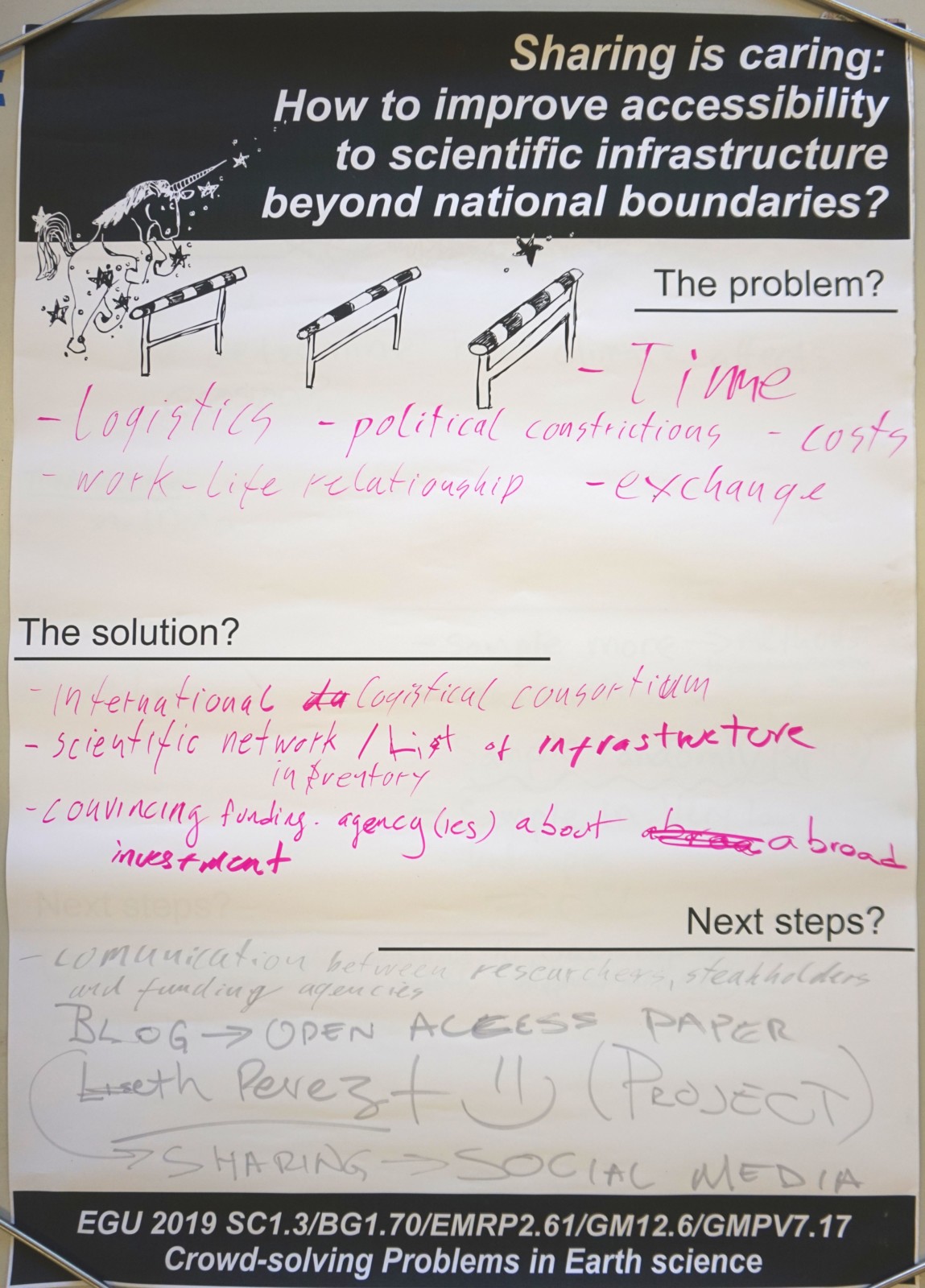
Sharing is caring: How to improve accessibility to scientific infrastructure beyond national boundaries? Credit: Johannes Buckel
Geoscientists want to ensure data quality, and thus ship their equipment, and materials abroad, and prefer to analyse collected scientific samples in their own laboratories. This is a challenge when conducting research and field work beyond national boundaries, especially in remote or conflict areas (Latin America, Iran, etc.). However, in the discussion we found out that these difficulties even arise within European countries.
There are several different kinds of research limiting issues that you can encounter when trying to get samples from across borders to your laboratory, including political restrictions, expensive shipment costs, long duration with associated delays in publications and graduation. A solution could be to improve accessibility to scientific infrastructure abroad. This would entail collaborating with local researchers and sharing equipment and laboratories. Feasible solutions could be:
- the creation of an international logistic consortium and a network of geoscientists working abroad,
- an international inventory of available infrastructure and laboratories, and
- convincing national or European financing agencies to invest abroad to avoid constant exportation and importation of equipment and samples.
We recognize that these are great solutions, but we need to take action to make them real. We urgently need to improve communication between researchers, stakeholders and financing agencies. To raise the pressure for change we can publish on the problem in an open access journal. We should take advantage of social media to interact among geoscientists working abroad and to share their experiences and possible solutions. We all could start caring about others, and actively share our scientific infrastructure without borders.
The mean mean: Can we trust average erosion rates?
(Günther Prasicek, University of Lausanne, Switzerland)
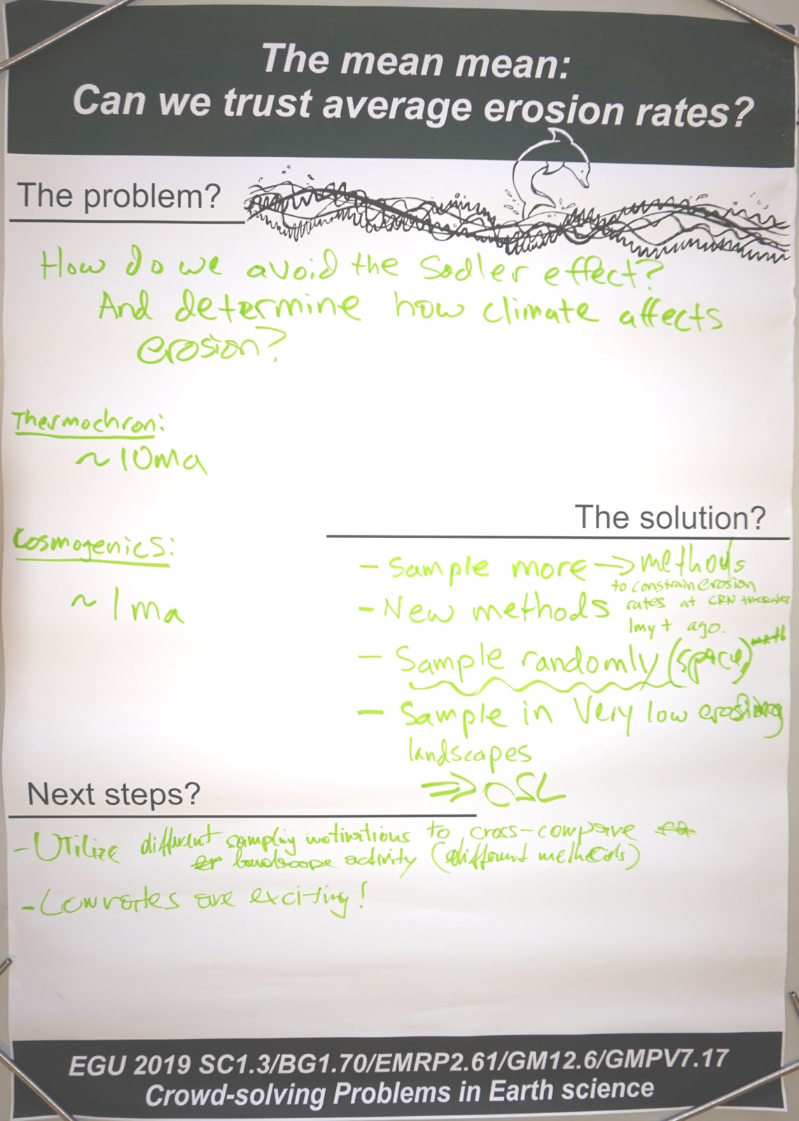
The mean mean: Can we trust average erosion rates? Credit: Johannes Buckel
We try to resolve the stochastic and sometimes random nature of surface processes, like erosion and sedimentation in both time and space, by averaging. By doing so we introduce biases and misleading impression. A mean thing about the mean rate is that processes might seem to be continuous, while in reality erosion and deposition rather occur as discrete pulses with hiatus, thus time spans without anything happening, in between. A common bias, such as the so-called Sadler effect, is introduced due to the temporal and spatial scales we average over.
The discussion posed a number of interesting questions: How can we approach these trust issues concerning the mean as they seem inevitable to many of Earth science research questions? Do we need methodological and conceptual frameworks which provide the bounds of the data as well as their interpretations? How can we stochastically scrutinize the data and its limit? How can we technically advance and thus trust mean rates?
To bring back this Meta discussion down to Earth, the proposed solutions are simple: let’s change the sampling strategies, sample more, spatially random and in very low erosion environments. Combine diverse methods to use varying spatial and temporal resolutions to bootstrap rates in between. And if possible, simply, develop new methods with different averaging time spans. Next steps in practice would be to first compile data of possible hiatus length and data from different methods/strategies, and then cross-compare their timespan and resulting rates at different landscape activities. We need to be ruthless with what we can actually tell with the mean data we have and should embrace low rates – as they are exciting!
We are planning on organising crowd-solving session(s) again next year. If anybody has any problems they want to solve, they can let us know!
By Eleanore Heasley (King’s College London, UK), Renee van Dongen and Anne Voigtländer (GFZ Potsdam, Germany), and Felix Nieberding, Liseth Perez and Johannes Buckel (TU Braunschweig, Germany)
Organizing team of the session also included: Harry Sanders and Richard Mason (Loughborough University, UK)