Imaggeo, our open access image repository, is packed with beautiful images showcasing the best of the Earth, space and planetary sciences. Throughout the year we use the photographs submitted to the repository to illustrate our social media and blog posts.
For the past few years we’ve celebrated the end of the year by rounding-up some of the best Imaggeo images. But it’s no easy task to pick which of the featured images are the best! Instead, we turned the job over to you! We compiled a Facebook album which included all the images we’ve used as header images across our social media channels and on Imaggeo on Mondays blog post in 2017 an asked you to vote for your favourites.
Today’s blog post rounds-up the best 12 images of Imaggeo in 2017, as chosen by you, our readers.
Of course, these are only a few of the very special images we highlighted in 2017, but take a look at our image repository, Imaggeo, for many other spectacular geo-themed pictures, including the winning images of the 2017 Photo Contest. The competition will be running again this year, so if you’ve got a flare for photography or have managed to capture a unique field work moment, consider uploading your images to Imaggeo and entering the 2018 Photo Contest.
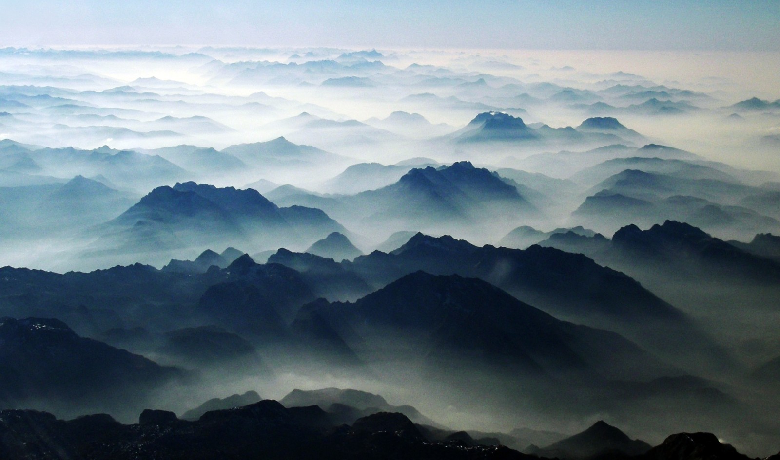
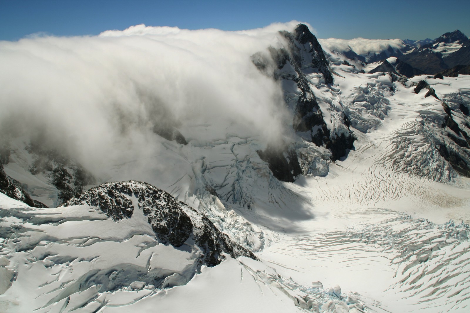
Alpine massifs above low level haze . Credit: Hans Volkert (distributed via imaggeo.egu.eu).
The forward scattering of sunlight, which is caused by a large number of aerosol particles (moist haze) in Alpine valleys, gives the mountain massifs a rather plastic appearance. The hazy area in the foreground lies above the Koenigsee lake; behind it the Watzmann, Hochkalter, Loferer Steinberge and Wilder Kaiser massifs loom up behind one other to the right of the centre line. Behind them is the wide Inn valley, which extends right across the picture.
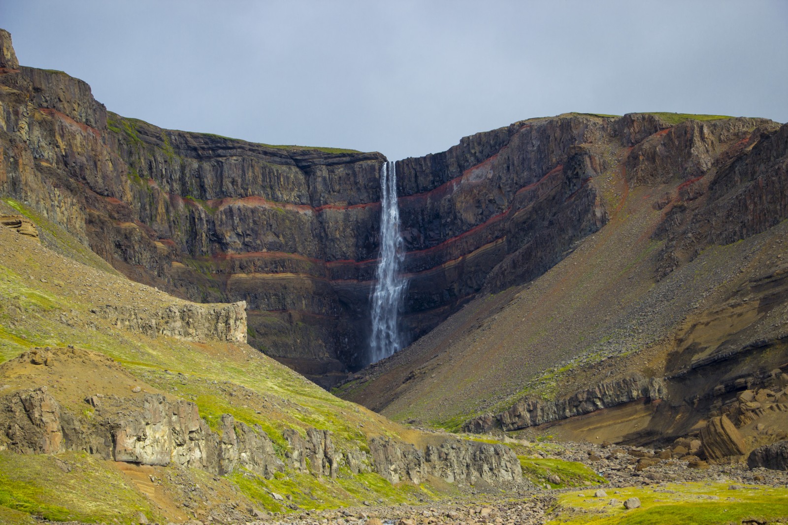
A lava layer cake flowing . Credit: Timothée Duguet (distributed via imaggeo.egu.eu)
Check out a post from back in May to discover how layers of alternating black lavas and red soils built up to form a giant ‘mille feuilles’ cake at Hengifoss, Iceland’s third-highest waterfall.
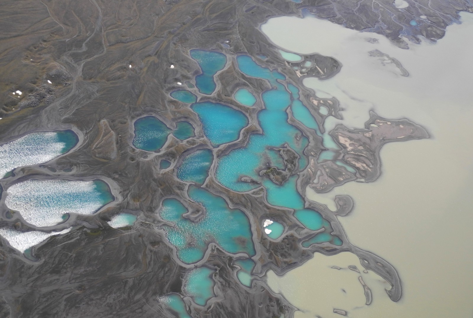
Sediment makes the colour . Credit: Eva P.S. Eibl (distributed via imaggeo.egu.eu)
Earth is spectacularly beautiful, especially when seen from a bird’s eye view. This image, of a sweeping pattern made by a river in Iceland is testimony to it. Follow the link to learn more about river Leirá which drains sediment-loaded glacial water from the Myrdalsjökull glacier in Iceland.
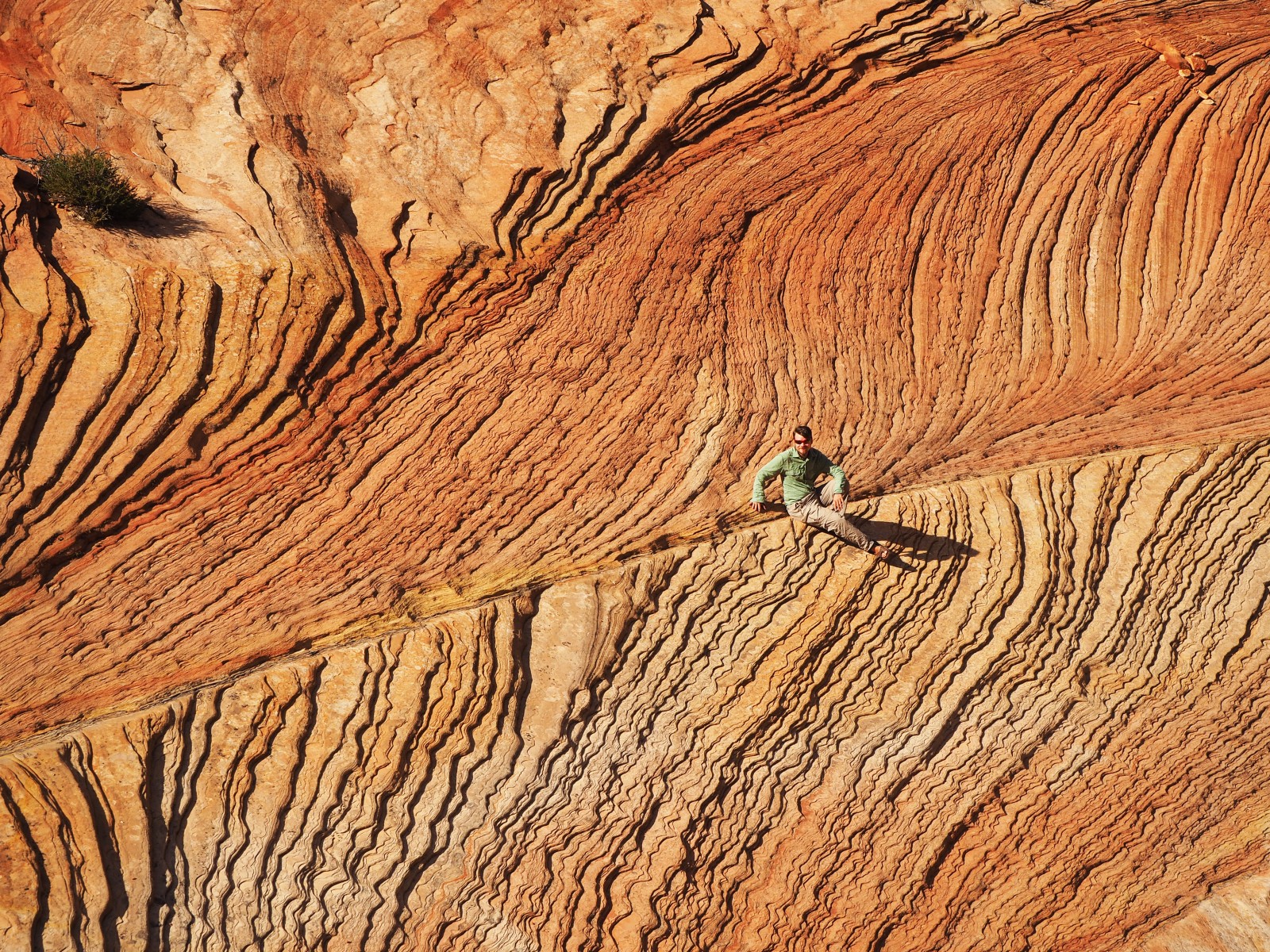
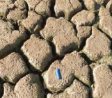
Movement of ancient sand . Credit: Elizaveta Kovaleva (distributed via imaggeo.egu.eu).
Snippets of our planet’s ancient past are frozen in rocks around the world. By studying the information locked in formations across the globe, geoscientist unpick the history of Earth. The layers in one of the winning images of the 2017 photo contest may seem abstract to the untrained eye, but Elizaveta Kovaleva (a researcher at the University of the Free State in South Africa) describes how they reveal the secrets of ancient winds and past deserts in a blog post we published in November.
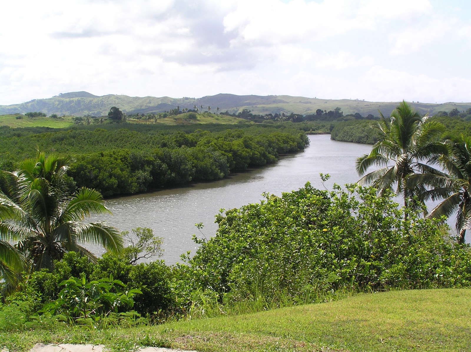
View of the Tuva River and central mountain range
. Credit: Lisa-Marie Shillito (distributed via imaggeo.egu.eu).
Initially, this photo may seem like any other tropical paradise: lush forests line a meandering river, but there is much more to the forests in the foreground than first meets the eye.
On the way back from Antarctica. Credit: Baptiste Gombert (distributed via imaggeo.egu.eu).
Our December 2017 header image – On the way back from Antarctica, by Baptiste Gombert – celebrated #AntarcticaDay.
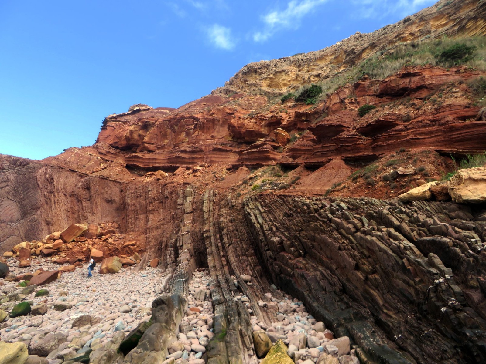
Angular unconformity. Credit: André Cortesão (distributed via imaggeo.egu.eu).
It is not unusual to observe abrupt contacts between two, seemingly, contiguous rock layers, such as the one seen above. This type of contact is called an unconformity and marks two very distinct times periods, where the rocks formed under very different conditions.
Find a new way . Credit: Stefan Winkler (distributed via imaggeo.egu.eu)
Stephan Winkler’s 2017 Imaggeo Photo Contest finalist photo showcases an unusual weather phenomenon…find out more about this process in the post from last year.
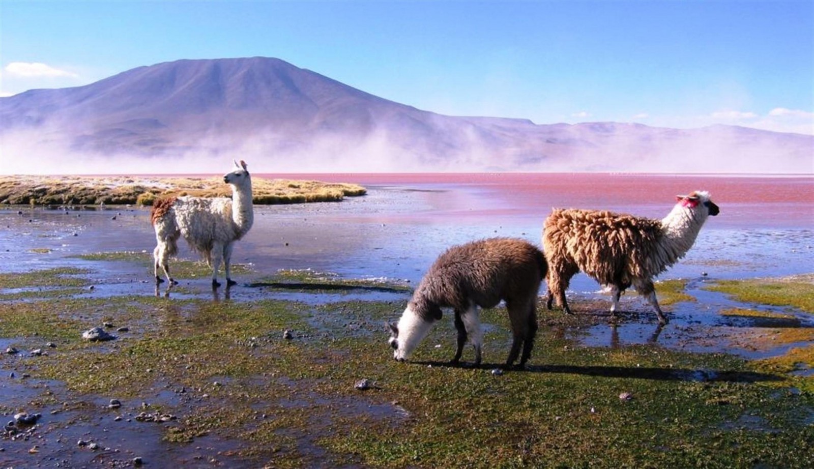
On the way back from Antarctica. Credit: Alicia Correa Barahona (distributed via imaggeo.egu.eu).
August’s social media header image showcases how, in the altiplano of Bolivia, Andean ecosystems, life and the hydrological cycle come together.
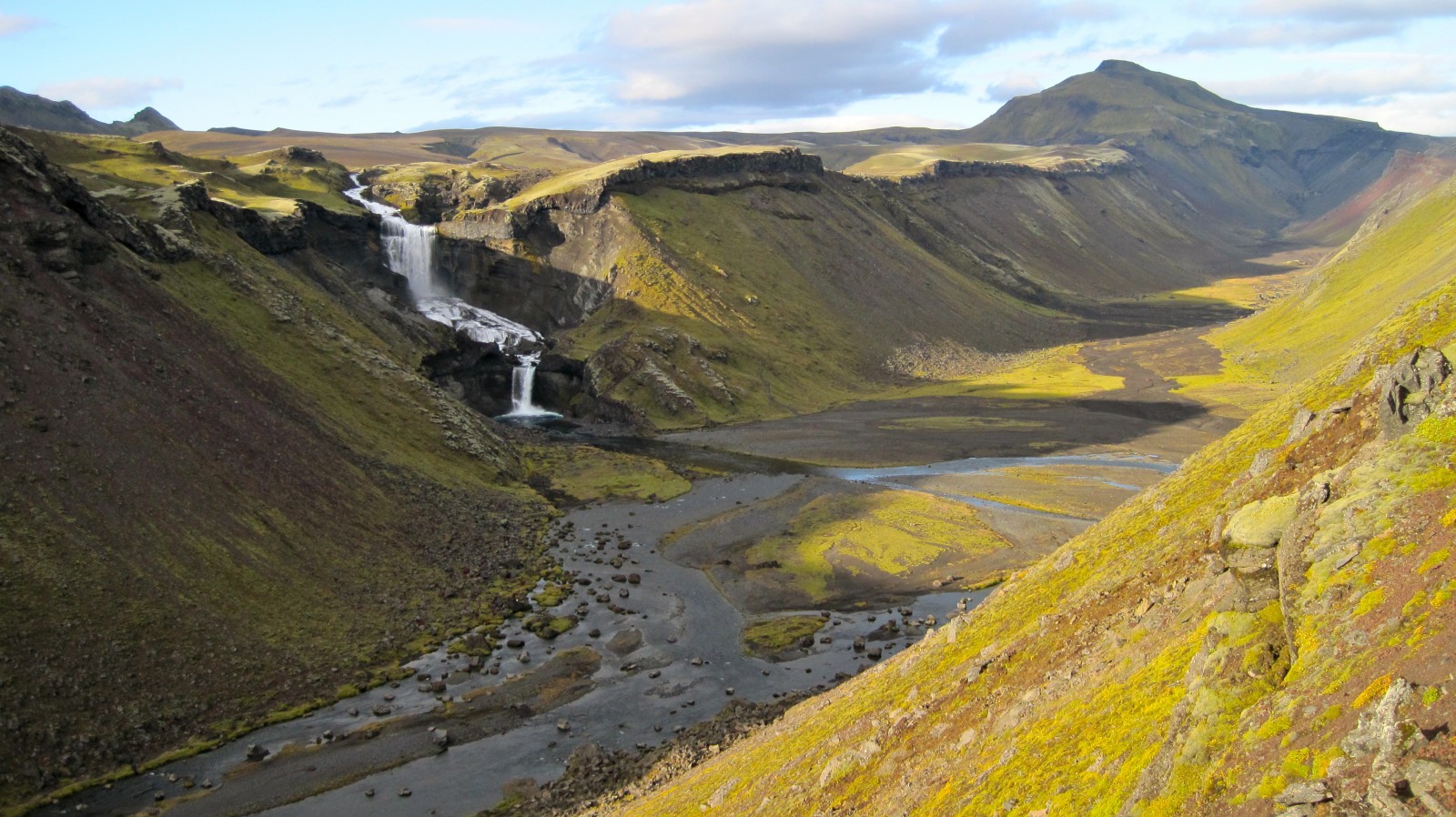
Icelandic valley created during a volcanic eruption. Credit: Manuel Queisser (distributed via imaggeo.egu.eu).
The image shows a valley in the highland of Iceland carved out during a volcanic eruption with lava coming from the area visible in the upper right corner. The landscape is playing with the viewers sense of relation as there is no reference. The valley is approximately 1 km wide. The lower cascade of the water fall is ca. 30 m high. A person (ca. 3 pixels wide) is located near the base of the water fall about 50 m away. It was our October header image.

Sedimentary record of catastrophic floods in the Atacama Desert
. Credit: Manu Abad (distributed via imaggeo.egu.eu).
Despite being one of the driest regions on Earth, the Atacama desert is no stranger to catastrophic flood events. This post highlights how the sands, clays and muds left behind once the flood waters recede can hold the key to understanding this natural hazard.

The heart of the Canadian Rocky Mountains. Credit: Jennifer Ziesch (distributed via imaggeo.egu.eu).
“I saw one of the most beautiful place on earth: The glacially-fed Moraine Lake in the Banff National Park, Canada. The lake is situated in the Valley of the Ten Peaks. The beautiful blue colour is due to the mix of glacier water and rock flour,” says Jennifer, who took the photograph of this tranquil setting.
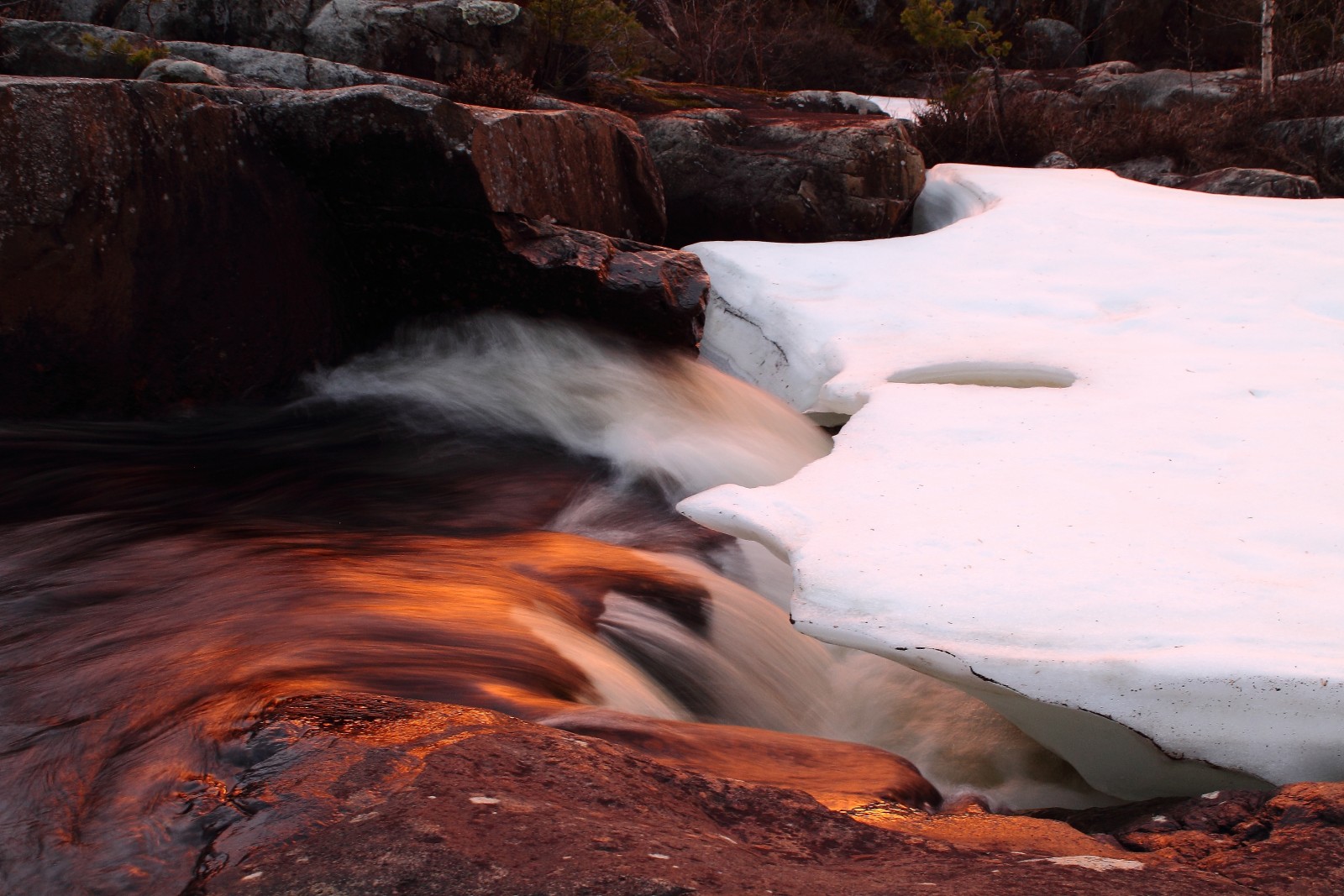
Symbiosis of fire, ice and water . Credit: Michael Grund (distributed via imaggeo.egu.eu)
This mesmerising photograph is another of the fabulous finalists (and winner) of the 2017 imaggeo photo contest. The picture, which you can learn more about in this blog post, was taken at Storforsen, an impressive rapid in the Pite River in northern Sweden, located close to the site of a temporary seismological recording station which is part of the international ScanArray project. The project focuses on mapping the crustal and mantle structure below Scandinavia using a dense temporary deployment of broadband seismometers.
f you pre-register for the 2018 General Assembly (Vienna, 08 – 13 April), you can take part in our annual photo competition! From 15 January up until 15 February, every participant pre-registered for the General Assembly can submit up three original photos and one moving image related to the Earth, planetary, and space sciences in competition for free registration to next year’s General Assembly! These can include fantastic field photos, a stunning shot of your favourite thin section, what you’ve captured out on holiday or under the electron microscope – if it’s geoscientific, it fits the bill. Find out more about how to take part at http://imaggeo.egu.eu/photo-contest/information/.