While the majority of us were midway through our Christmas Day celebrations, a powerful 7.6 M earthquake struck off the western coast of the Chile. Natural hazards are not bound by time, location or festivities; an earthquake can happen at any time in any place, regardless of the significance of the day. As a result, in this earthquake prone region, raising awareness of the risk posed by natural hazards is vitally important.
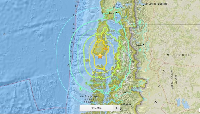
The Christmas Day quake struck 42 km south west of the port city of Quellón, on the rural island of Chiloé at a depth of 34 km. Despite the powerful shaking, the tremor caused no casualties and damage to infrastructure was limited. For a time, services (such as water and power) to the southern tip of Chiloé were cut. Most affected were roads and bridges, particularly the recently renovated highway 5, which links Quellón with the fishing town of Chonchi.
The earthquake triggered a tsunami warning, leading to the evacuation of 4000 people in the coastal areas of Los Lagos Region, including the towns of Quellón and Chonchi. However, no tsunami waves were reported and the warning was lifted some 90 minutes after the temblor.
Chile’s long history of powerful earthquakes
As recently as September 2015, an 8.3 M tremor hit Illapel, causing 13 casualties, 6 missing and triggering a 4.5 m tsunami wave, with shaking felt as far as Bolivia and Argentina.
A powerful, and destructive, 8.8 M quake struck Maule in February 2010. On land, there was severe loss to infrastructure and housing, while a tsunami wave caused significant damage to coastal areas. Combined, the earthquake and tsunami resulted in the deaths of more than 500 people.
The most powerful tremor ever recorded, the estimated 9.5 M Valdivia earthquake, struck Chile in May 1960. More than 2,000 people were reported dead, a further 3,000 went missing and over 2,000,000 were left homeless. The damage in Southern Chile alone amounted to over $550 million. Tsunami waves generated by the quake struck Hawaii, Japan, the Philippines and the western USA coast, causing a further $50.5 million in damages and killing 231 people.
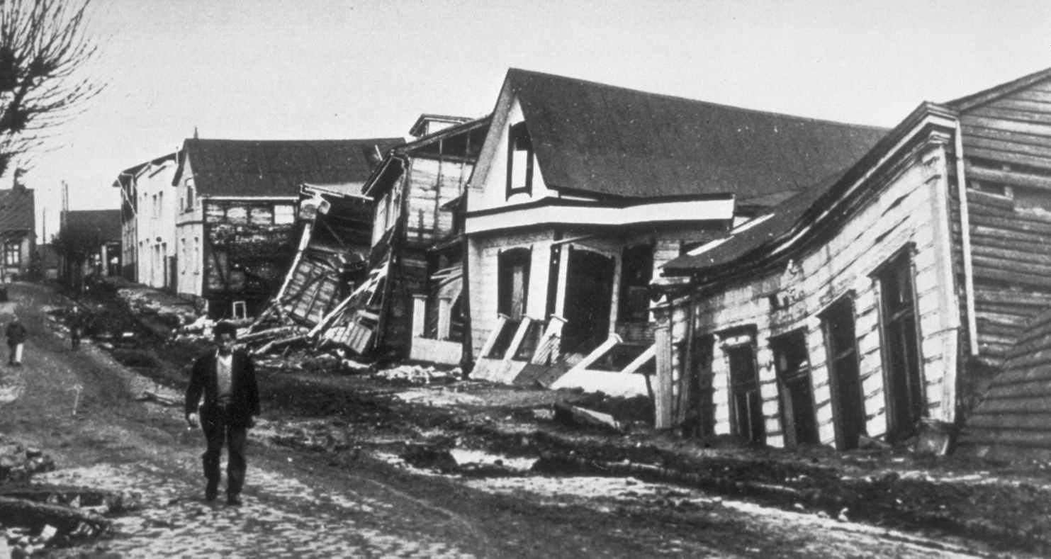
Damage to several houses in Chile after the earthquake. Credit: Pierre St. Amand – NGDC Natural Hazards Slides with Captions Header, Public Domain (distributed by Wikimedia Commons)
What causes earthquakes in Chile and what does the future hold?
Chile lies along the Pacific Ring of Fire, an area known for its high seismic and volcanic activity. Here, tectonic plates slide against each other, pull apart or converge and subduct under one another generating geologically active zones.
To understand why powerful earthquakes occur in Chile, we asked Cindy Mora Stock, a seismologist at the University of Concepción (Chile), to give us a more detailed insight into the tectonics of the region:
Earthquakes along the Chilean coast occur at the interface between the South American plate and the subducted Nazca plate. The rapid velocity between these plates (66 – 90 mm/yr) increases the potential for great earthquakes in the region, presenting on average an event of magnitude 8, or larger, every ten years. As a comparison, the Antarctic plate subducts under South American plate at a much slower rate (16 – 22 mm/yr).
The latest Mw 7.6 earthquake near Quellón on 25th of December [1], falls in the central part of the rupture zone (the portion of the fault which slipped during) of the Valdivia earthquake – roughly 380 km south from Valdivia.
A study by Lange et al in 2007 showed a cluster of four main 4.0 < Ml < 4.4 events and their afteshocks, occurring at the interface between 12-30 km depth, beneath the western coast of Chiloe Island. Another study by Moreno et al in 2011 shows some patches at the interface that ruptured during the previous 1960 event, which are more stuck than other areas at the same interface.
Especially, computer simulations show the interface at the center part of the 1960’s rupture zone is fully locked, this means that part is “stuck”, not moving, and accumulating energy. Zones that present a high locking rate have shown to be prone areas for the nucleation of a great earthquake in the future. Although in all presented scenarios the Chiloe Island presents a high locking rate, this is not enough to state a range of time when an earthquake will occur at this patch. Considering this, the previous seismicity, and the present Mw7.6 earthquake in the region it might seem like the interface might have ended its and it is starting to build up stress for a future earthquake.
By Laura Roberts, EGU Communications Officer, and Cindy Mora Stock, postdoctoral researcher at the University of Concepcion, Chile.
References and further reading
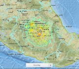
[1] Intensities of shaking felt after the 25 December earthquake (in Spanish): http://www.sismologia.cl/events/sensibles/2016/12/25-1422-28L.S201612.html
[2] Lange, D., Rietbrock, A., Haberland, E., et al.: Seismicity and geometry of the south Chilean subduction zone (41.5°S–43.5°S): Implications for controlling parameters, Geophysical Research Letters, 34, L06311, doi: 0.1029/2006GL029190, 2007
[3] Moreno, M., Melnick, D., Rosenau, M., et al.: Heterogeneous plate locking in the South–Central Chile subduction zone: Building up the next great earthquake, Earth and Planetary Research Letters, 305, 3-4, 413-424, doi: 10.1016/j.epsl.2011.03.025, 2011 (Paywalled)
USGS overview of M7.6 – 42km SW of Puerto Quellon, Chile (includes shake maps, regional tectonic information and moment tensor details): http://earthquake.usgs.gov/earthquakes/eventpage/us10007mn3#executive
Understanding Tectonic Processes Following Great Earthquakes (Eos: Earth & Space Science News)
25 December earthquake in the news:
· Chile earthquake tsunami warning lifted (BBC News report)
· Major quake jolts Chile tourist region on Christmas Day (Reuters in-depth news report)
· Chile jolted by major 7.6-magnitude earthquake (Guardian News)
· Imagenes del terremoto al sur de Chile (in Spanish: Images of the earthquake in Southern Chile – Gestión, diario de econimía y negocios de Perú)